Cof Cymru: National Historic Assets of Wales · Wales
St Issui's Well
The Vale of Grwyney, Powys, Wales
A Grade II listed building in Partrishow, The Vale of Grwyney, Powys, designated on 19 July 1963.
The record
- Designation
- Listed building, Grade II
- Broad class
- Religious, Ritual and Funerary
- Date of designation
- 19 July 1963
- Locality
- Partrishow
- Community
- The Vale of Grwyney
- Unitary authority
- Powys
- Country
- Wales
- Coordinates
- 51.89571, -3.05003
- Cadw reference
- 6689
Slide toward Today to fade the historical sheet and see the modern map underneath.
David Rumsey Map Collection, Stanford LibrariesDavid Rumsey Map Collection, Stanford LibrariesDavid Rumsey Map Collection, Stanford LibrariesDavid Rumsey Map Collection, Stanford LibrariesDavid Rumsey Map Collection, Stanford Libraries
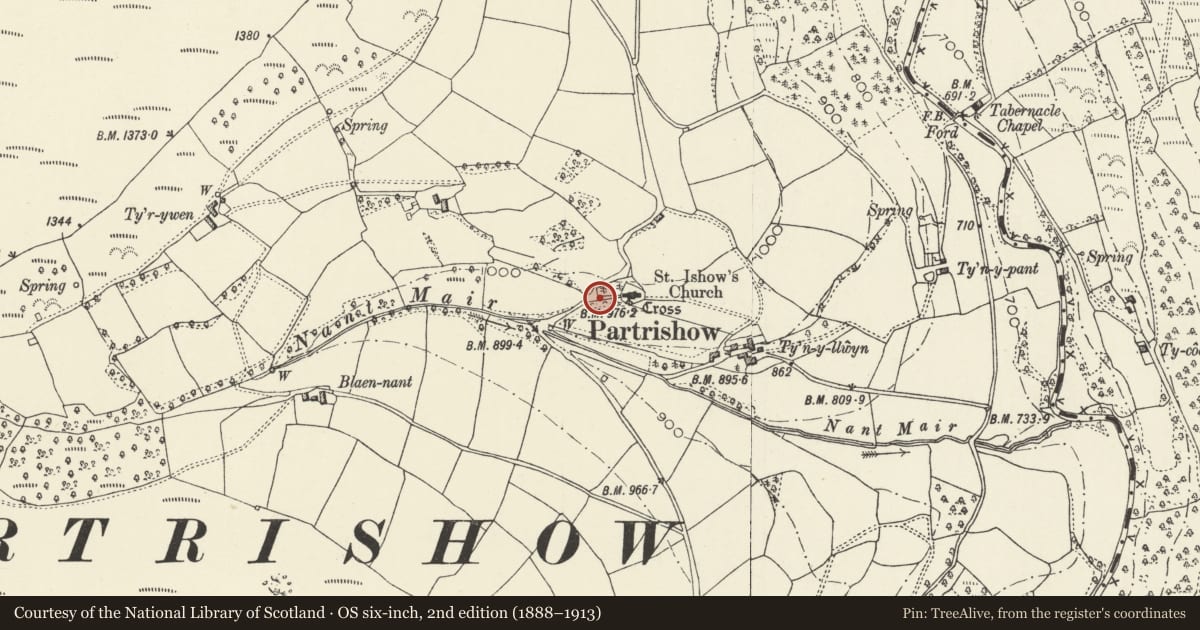
5 historical maps cover this location, the earliest the 1636 map "Cornubia : Devonia, Somersetus, Dorcestria, Wiltonia, Glocestria ..." (David Rumsey Map Collection, Stanford Libraries).
Historical maps covering this location
- 1636 · Cornubia : Devonia, Somersetus, Dorcestria, Wiltonia, Glocestria ... (David Rumsey Map Collection, Stanford Libraries)
- 1856 · 42. Brecon. (David Rumsey Map Collection, Stanford Libraries)
- 1895 · Sheet 11. Ordnance Survey of England and Wales. (David Rumsey Map Collection, Stanford Libraries)
- 1896 · 214 Talgarth (Hills) (David Rumsey Map Collection, Stanford Libraries)
- 1901 · Sheet 14. (David Rumsey Map Collection, Stanford Libraries)
Cadw's description
Location
On E side of minor road and on N bank of river in a dingle SW of parish church.
History
Probably the site of a pre Christian shrine which influenced the siting of the church here. It is traditionally associated with Issui, who was said to have had a cell nearby and who was canonised after his murder by a traveller. The water was also said to possess healing properties and to have attracted pilgrims. The present structure is probably a C18 or C19 rebuild.
Exterior
Consisting of a shallow spring feeding a pool, with rubble stone walls on N, W and E sides. The wall on E side is integral with a field wall, the walls on N and W sides are built into a bank. In the N wall is a plain niche and an opening at the base where water flows into the small pool. A stone slab canopy covers the pool. The E and W walls also enclose flagstones on the S side.
Reason for designation
Included for its historical associations with Partrishow and the early Celtic Church.
Nearby in the register
- Lych Gate at Church of St Issui, PartrishowReligious, Ritual and Funeraryunder 1 mi
- Former Stable at Church of St Issui, PartrishowDomesticunder 1 mi
- Church of St Issui, PartrishowReligious, Ritual and Funeraryunder 1 mi
- Churchyard cross at Church of St Issui, PartrishowReligious, Ritual and Funeraryunder 1 mi
Other entries of the same register within about three miles of this one, by straight line.