Cof Cymru: National Historic Assets of Wales · Wales
Penmon Cross
Llangoed, Isle of Anglesey, Wales
A scheduled monument in Llangoed, Isle of Anglesey, recorded as Cross (Early Medieval).
The record
- Designation
- Scheduled monument
- Site type
- Cross
- Period
- Early Medieval
- Welsh name
- Croes Penmon
- Community
- Llangoed
- Unitary authority
- Isle of Anglesey
- Country
- Wales
- Coordinates (centre of the scheduled area)
- 53.30574, -4.05676
- SAM number
- AN063
- Cadw record number
- 3266
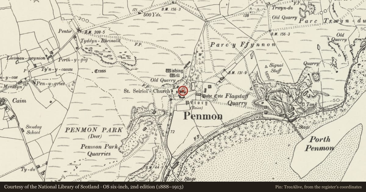
Slide toward Today to fade the historical sheet and see the modern map underneath.
David Rumsey Map Collection, Stanford LibrariesDavid Rumsey Map Collection, Stanford LibrariesDavid Rumsey Map Collection, Stanford LibrariesDavid Rumsey Map Collection, Stanford LibrariesDavid Rumsey Map Collection, Stanford Libraries
5 historical maps cover this location, the earliest the 1883 map "Watershed map England, Wales 3." (David Rumsey Map Collection, Stanford Libraries).
Historical maps covering this location
- 1883 · Watershed map England, Wales 3. (David Rumsey Map Collection, Stanford Libraries)
- 1896 · Sheet 7. Ordnance Survey of England and Wales. (David Rumsey Map Collection, Stanford Libraries)
- 1899 · 94 Beaumaris (Hills) (David Rumsey Map Collection, Stanford Libraries)
- 1901 · Sheet 9 and 10. (David Rumsey Map Collection, Stanford Libraries)
- 1919 · Sheet 41. Anglesey. (David Rumsey Map Collection, Stanford Libraries)
Cadw's description
Summary description and reason for designation
The following provides a general description of the Scheduled Monument.
The monument consists of a medieval cross, now located in the nave of St Seiriol's Church, Penmon. Its base, shaft and head are all highly ornamented and all date to approximately 1000 AD. The ornament is a variety of plaits and fret patterns showing Scandinavian influence. The figure on the front of the shaft shows the temptation of St. Anthony with the saint surrounded by demons.
The shaft is tenoned into mortices in the other parts. The head may belong to another cross but alternatively the cross was once taller with an extra section between the head and present shaft.
The monument is of national importance for its potential to enhance our knowledge of medieval religious practices.
The scheduled area comprises the remains described.
Nearby in the register
- Priory Church of St SeiriolReligious, Ritual and Funeraryunder 1 mi
- Priory house outbuildingDomesticunder 1 mi
- Refectory at Penmon PrioryReligious, Ritual and Funeraryunder 1 mi
- Priory HouseDomesticunder 1 mi
Other entries of the same register within about three miles of this one, by straight line.