Cof Cymru: National Historic Assets of Wales · Wales
Priory house outbuilding
Llangoed, Isle of Anglesey, Wales
A Grade II listed building in Penmon, Llangoed, Isle of Anglesey, designated on 17 July 2002.
The record
- Designation
- Listed building, Grade II
- Broad class
- Domestic
- Date of designation
- 17 July 2002
- Locality
- Penmon
- Community
- Llangoed
- Unitary authority
- Isle of Anglesey
- Country
- Wales
- Coordinates
- 53.30560, -4.05666
- Cadw reference
- 26765
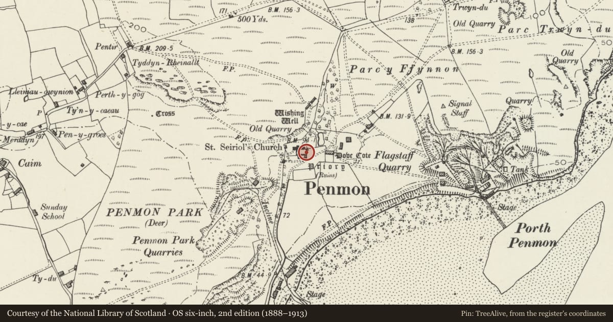
Slide toward Today to fade the historical sheet and see the modern map underneath.
David Rumsey Map Collection, Stanford LibrariesDavid Rumsey Map Collection, Stanford LibrariesDavid Rumsey Map Collection, Stanford LibrariesDavid Rumsey Map Collection, Stanford LibrariesDavid Rumsey Map Collection, Stanford Libraries
5 historical maps cover this location, the earliest the 1883 map "Watershed map England, Wales 3." (David Rumsey Map Collection, Stanford Libraries).
Historical maps covering this location
- 1883 · Watershed map England, Wales 3. (David Rumsey Map Collection, Stanford Libraries)
- 1896 · Sheet 7. Ordnance Survey of England and Wales. (David Rumsey Map Collection, Stanford Libraries)
- 1899 · 94 Beaumaris (Hills) (David Rumsey Map Collection, Stanford Libraries)
- 1901 · Sheet 9 and 10. (David Rumsey Map Collection, Stanford Libraries)
- 1919 · Sheet 41. Anglesey. (David Rumsey Map Collection, Stanford Libraries)
Cadw's description
Location
Slightly set back from the N side of a country road leading to the SE tip of the island at Black Point, or Trwyn Du, Penmon. The outbuilding is set in the SE corner of the cloister yard; abutting the refectory building to the S.
History
The date of the outbuilding is unknown, but appears to contain fabric of the C16 refectory warming house which it abuts; the elevations raised and remodelled probably in the mid C19 when the chancel of the adjacent Priory Church was rebuilt.
Exterior
Small single storey outbuilding built of rubble masonry with a slate roof and tall tapering stack in the SE corner. The W doorway opens into the cloister yard; small-paned lights in the S gable.
Interior
Interior not inspected at the time of the survey.
Reason for designation
Included as an important component of the conventual buildings set around the cloister court by the Priory Church of St Seiriol.
Ancient Monument No 1/1838/AN 027 (ANG) G.
Nearby in the register
- Refectory at Penmon PrioryReligious, Ritual and Funeraryunder 1 mi
- Penmon PrioryPrioryunder 1 mi
- Penmon CrossCrossunder 1 mi
- Priory HouseDomesticunder 1 mi
Other entries of the same register within about three miles of this one, by straight line.