Cof Cymru: National Historic Assets of Wales · Wales
Llwyn House
Trawsgoed, Ceredigion, Wales
A Grade II listed building in Llanfihangell y Creuddyn, Aberystwyth, Trawsgoed, Ceredigion, designated on 21 January 1964.
The record
- Designation
- Listed building, Grade II
- Broad class
- Domestic
- Date of designation
- 21 January 1964
- Locality
- Llanfihangell y Creuddyn
- Town
- Aberystwyth
- Community
- Trawsgoed
- Unitary authority
- Ceredigion
- Country
- Wales
- Coordinates
- 52.36644, -3.96170
- Cadw reference
- 9856
Slide toward Today to fade the historical sheet and see the modern map underneath.
David Rumsey Map Collection, Stanford LibrariesDavid Rumsey Map Collection, Stanford LibrariesDavid Rumsey Map Collection, Stanford LibrariesDavid Rumsey Map Collection, Stanford LibrariesDavid Rumsey Map Collection, Stanford Libraries
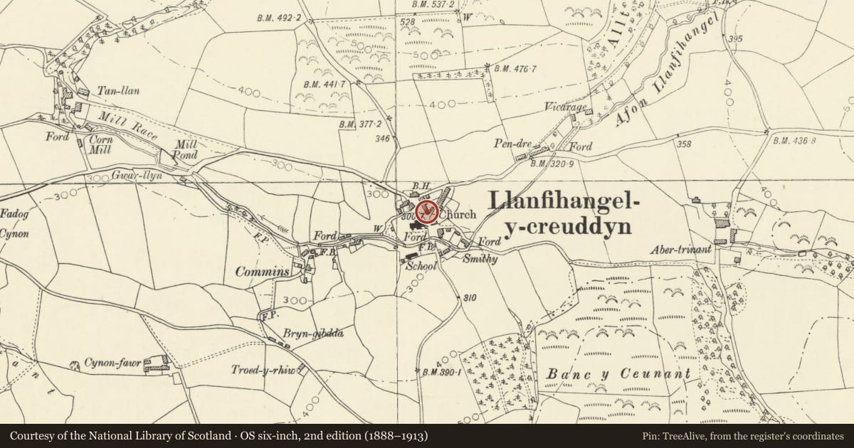
5 historical maps cover this location, the earliest the 1830 map "V.3:11-15:XV. Britisches Reich. A. Kon: England. b. Frstenthum Wales: Shire: 37-40" (David Rumsey Map Collection, Stanford Libraries).
Historical maps covering this location
- 1830 · V.3:11-15:XV. Britisches Reich. A. Kon: England. b. Frstenthum Wales: Shire: 37-40 (David Rumsey Map Collection, Stanford Libraries)
- 1883 · Watershed map England, Wales 3. (David Rumsey Map Collection, Stanford Libraries)
- 1896 · Sheet 7. Ordnance Survey of England and Wales. (David Rumsey Map Collection, Stanford Libraries)
- 1899 · 178 Llanilar (Hills) (David Rumsey Map Collection, Stanford Libraries)
- 1901 · Sheet 14. (David Rumsey Map Collection, Stanford Libraries)
Cadw's description
Location
The end house in row of 4 facing W across village square.
History
Earlier C19 terraced house, a pair with Ceunant House.
Exterior
Terraced house, painted rubble stone with slate close-eaved roof and C20 rebuilt stacks in black brick to left, large rubble stone right stack taken down in 2003. Two storeys, double-fronted with hornless 9-pane sashes above, larger hornless 12-pane sashes below and centre half-glazed door. Painted brick heads to ground floor openings, painted stone sills. Rendered right end wall with first floor horned 4-pane sash, narrow lean-to addition to rear in painted brick with casement window and board door.
Interior
Not inspected at time of survey.
Reason for designation
Included as part of an early C19 terrace of houses prominent in centre of village, this house retaining good C19 character.
Nearby in the register
- Ceunant HouseDomesticunder 1 mi
- CartrefDomesticunder 1 mi
- Lisburne HouseDomesticunder 1 mi
- Creuddyn VillaDomesticunder 1 mi
Other entries of the same register within about three miles of this one, by straight line.