Cof Cymru: National Historic Assets of Wales · Wales
Former Emlyn Grammer School
Newcastle Emlyn, Carmarthenshire, Wales
A Grade II listed building in Newcastle Emlyn, Carmarthenshire, designated on 5 August 1991.
The record
- Designation
- Listed building, Grade II
- Broad class
- Recreational
- Date of designation
- 5 August 1991
- Community
- Newcastle Emlyn
- Unitary authority
- Carmarthenshire
- Country
- Wales
- Coordinates
- 52.03620, -4.46897
- Cadw reference
- 9714
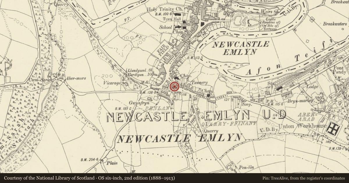
Slide toward Today to fade the historical sheet and see the modern map underneath.
David Rumsey Map Collection, Stanford LibrariesDavid Rumsey Map Collection, Stanford LibrariesDavid Rumsey Map Collection, Stanford LibrariesDavid Rumsey Map Collection, Stanford LibrariesDavid Rumsey Map Collection, Stanford Libraries
5 historical maps cover this location, the earliest the 1830 map "V.3:11-15:XV. Britisches Reich. A. Kon: England. b. Frstenthum Wales: Shire: 37-40" (David Rumsey Map Collection, Stanford Libraries).
Historical maps covering this location
- 1830 · V.3:11-15:XV. Britisches Reich. A. Kon: England. b. Frstenthum Wales: Shire: 37-40 (David Rumsey Map Collection, Stanford Libraries)
- 1860 · 41. Caermathen. (David Rumsey Map Collection, Stanford Libraries)
- 1891 · Sheet 10. Ordnance Survey of England and Wales. . (David Rumsey Map Collection, Stanford Libraries)
- 1898 · 211 Newcastle Emlyn (Hills) (David Rumsey Map Collection, Stanford Libraries)
- 1901 · Sheet 14. (David Rumsey Map Collection, Stanford Libraries)
Cadw's description
Location
The last building on road out from Fountain Square to the Carmarthen Road, though formerly in a terrace row. On street line.
History
Apparently a private school founded at Llanybri House, Adpar, by
Rev J Davies, later in a disused Baptist Chapel, Adpar, before being relocated here 1867. The building may be earlier C19 and reused, as the style suggests circa 1820-40, but there is no clear documentation. In 1867 T T Elias, landlord of the Plough Inn and lessee of the market, was proprietor and headmaster.
Exterior
Dated 1867, former school.Small single storey double-fronted building with roughcast facing and slate roof. Centre door and small-paned window each side, all with elliptical arched heads and Y-tracery bars to upper sash and fanlight. Double panelled doors. Over the door is plaque reading: 'Emlyn Grammar School 1867'. Roof has corrugated iron cladding on ridge replacing former ventilator. Now used as Women's Institute Hall.
Nearby in the register
- Emlyn Castle (All Kings Premises)Commercialunder 1 mi
- Baptist Chapel, including Sunday School forecourt railings & gates.Religious, Ritual and Funeraryunder 1 mi
- Pillar Box outside Midland BankCommunicationsunder 1 mi
- Milepost behind No. 24, BlaenwernTransportunder 1 mi
Other entries of the same register within about three miles of this one, by straight line.