Cof Cymru: National Historic Assets of Wales · Wales
Bryn Disgwylfa
Denbigh, Denbighshire, Wales
A Grade II listed building in Denbigh - Town, Denbigh, Denbighshire, designated on 2 February 1981.
The record
- Designation
- Listed building, Grade II
- Broad class
- Domestic
- Date of designation
- 2 February 1981
- Locality
- Denbigh - Town
- Community
- Denbigh
- Unitary authority
- Denbighshire
- Country
- Wales
- Coordinates
- 53.18582, -3.41928
- Cadw reference
- 965
Slide toward Today to fade the historical sheet and see the modern map underneath.
David Rumsey Map Collection, Stanford LibrariesLlyfrgell Genedlaethol Cymru – The National Library of WalesDavid Rumsey Map Collection, Stanford LibrariesDavid Rumsey Map Collection, Stanford LibrariesDavid Rumsey Map Collection, Stanford Libraries
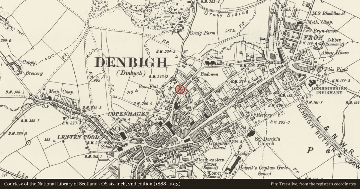
5 historical maps cover this location, the earliest the 1608 map "(13) Cambriae Typus." (David Rumsey Map Collection, Stanford Libraries).
Historical maps covering this location
- 1608 · (13) Cambriae Typus. (David Rumsey Map Collection, Stanford Libraries)
- 1795 · To Sir Watkin Williams-Wynn Bart ... the map of the six counties of North Wales is most… (Llyfrgell Genedlaethol Cymru – The National Library of Wales)
- 1830 · V.3:11-15:XV. Britisches Reich. A. Kon: England. b. Frstenthum Wales: Shire: 37-40 (David Rumsey Map Collection, Stanford Libraries)
- 1883 · Watershed map England, Wales 3. (David Rumsey Map Collection, Stanford Libraries)
- 1901 · Sheet 9 and 10. (David Rumsey Map Collection, Stanford Libraries)
Cadw's description
Location
On the street-line.
History
Second-half C18 town house, the home of Thomas Jones, the notable Calvinistic Methodist theologian and author (1756-1820).
Exterior
Large 3-storey town house of roughcast over rubble and brick construction, with stucco quoins, architraves and sill-courses (all of c1900). Slate roof with simple brick end chimneys. Symmetrical 3-bay facade with central entrance, with an open canopy porch carried on slim cast iron columns; 4-panel door with 3-pane rectangular overlight. Flush 12-pane modern windows (imitating sashes) to the ground and first floors, and similar 6-pane window to the top floor R; blind 12-pane casement to the L. All have cambered heads with lugged stucco architraves and projecting sills and keystones. Partial (later) outshut to the rear. To the L of the entrance is a modern plaque recording the fact that Thomas Jones (1756-1820) lived here.
Reason for designation
Listed for its special interest as a late C18 town house, the home of Thomas Jones, the notable Methodist minister.
Group value with nos 11-37 Beacon''''s Hill.
Nearby in the register
- 37 Beacon's HillDomesticunder 1 mi
- 35 Beacon's HillDomesticunder 1 mi
- 33 Beacon's HillDomesticunder 1 mi
- 31 Beacon's HillDomesticunder 1 mi
Other entries of the same register within about three miles of this one, by straight line.