Cof Cymru: National Historic Assets of Wales · Wales
31 Beacon's Hill
Denbigh, Denbighshire, Wales
A Grade II listed building in Denbigh - Town, Denbigh, Denbighshire, designated on 20 July 2000.
The record
- Designation
- Listed building, Grade II
- Broad class
- Domestic
- Date of designation
- 20 July 2000
- Locality
- Denbigh - Town
- Community
- Denbigh
- Unitary authority
- Denbighshire
- Country
- Wales
- Coordinates
- 53.18564, -3.41947
- Cadw reference
- 23563
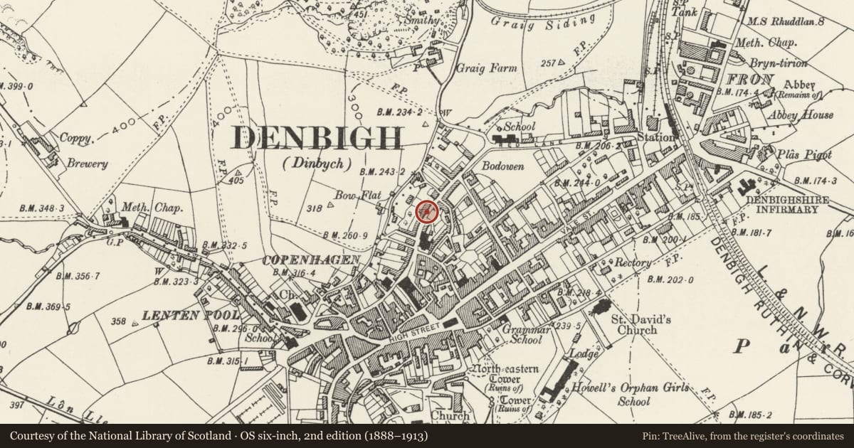
Slide toward Today to fade the historical sheet and see the modern map underneath.
David Rumsey Map Collection, Stanford LibrariesLlyfrgell Genedlaethol Cymru – The National Library of WalesDavid Rumsey Map Collection, Stanford LibrariesDavid Rumsey Map Collection, Stanford LibrariesDavid Rumsey Map Collection, Stanford Libraries
5 historical maps cover this location, the earliest the 1608 map "(13) Cambriae Typus." (David Rumsey Map Collection, Stanford Libraries).
Historical maps covering this location
- 1608 · (13) Cambriae Typus. (David Rumsey Map Collection, Stanford Libraries)
- 1795 · To Sir Watkin Williams-Wynn Bart ... the map of the six counties of North Wales is most… (Llyfrgell Genedlaethol Cymru – The National Library of Wales)
- 1830 · V.3:11-15:XV. Britisches Reich. A. Kon: England. b. Frstenthum Wales: Shire: 37-40 (David Rumsey Map Collection, Stanford Libraries)
- 1883 · Watershed map England, Wales 3. (David Rumsey Map Collection, Stanford Libraries)
- 1901 · Sheet 9 and 10. (David Rumsey Map Collection, Stanford Libraries)
Cadw's description
Location
On the street line.
Exterior
Belongs to a group of 14.
Nos 11-37 Beacon's Hill (odd numbers, inclusive).
Long staggered terrace of second-half C19 cottages descending the hill in a broad curve. The terrace consists of 13 one-window, 2-storey cottages which, with the exception of the end units and nos 25 and 27, are arranged as reflected pairs. No.11 has an additional window to the ground floor and has earlier brickwork to the lower part of its chimney, suggesting earlier, perhaps second-quarter or mid C19 origins for this unit. The terrace is constructed of rendered brick with shared brick stacks; slate roofs with tiled ridges. The stacks to nos 13 and 15 and nos 21-5 are rendered and the roof, continuous until no.15, steps down slightly in blocks of (mostly) two as the terrace descends the hill. Recessed doors of late Victorian 4-panel type, those to nos 33 and 35 part-glazed. The doors to nos 11, 17, 23, 27, 29, 31 and 37 are modern; no. 29 has an additional entrance with boarded door to the L. Plain, recessed 4-pane sashes with projecting stone sills.
Reason for designation
Listed for its special interest as forming part of an unusually complete terrace of late C19 town cottages retaining good external character.
Nearby in the register
- 29 Beacon's HillDomesticunder 1 mi
- 33 Beacon's HillDomesticunder 1 mi
- 35 Beacon's HillDomesticunder 1 mi
- 27 Beacon's HillDomesticunder 1 mi
Other entries of the same register within about three miles of this one, by straight line.