Cof Cymru: National Historic Assets of Wales · Wales
The Limes
Laugharne Township, Carmarthenshire, Wales
A Grade II listed building in Laugharne Township, Carmarthenshire, designated on 30 November 1966.
The record
- Designation
- Listed building, Grade II
- Broad class
- Domestic
- Date of designation
- 30 November 1966
- Community
- Laugharne Township
- Unitary authority
- Carmarthenshire
- Country
- Wales
- Coordinates
- 51.77265, -4.46291
- Cadw reference
- 9631
Slide toward Today to fade the historical sheet and see the modern map underneath.
David Rumsey Map Collection, Stanford LibrariesDavid Rumsey Map Collection, Stanford LibrariesDavid Rumsey Map Collection, Stanford LibrariesDavid Rumsey Map Collection, Stanford LibrariesDavid Rumsey Map Collection, Stanford Libraries
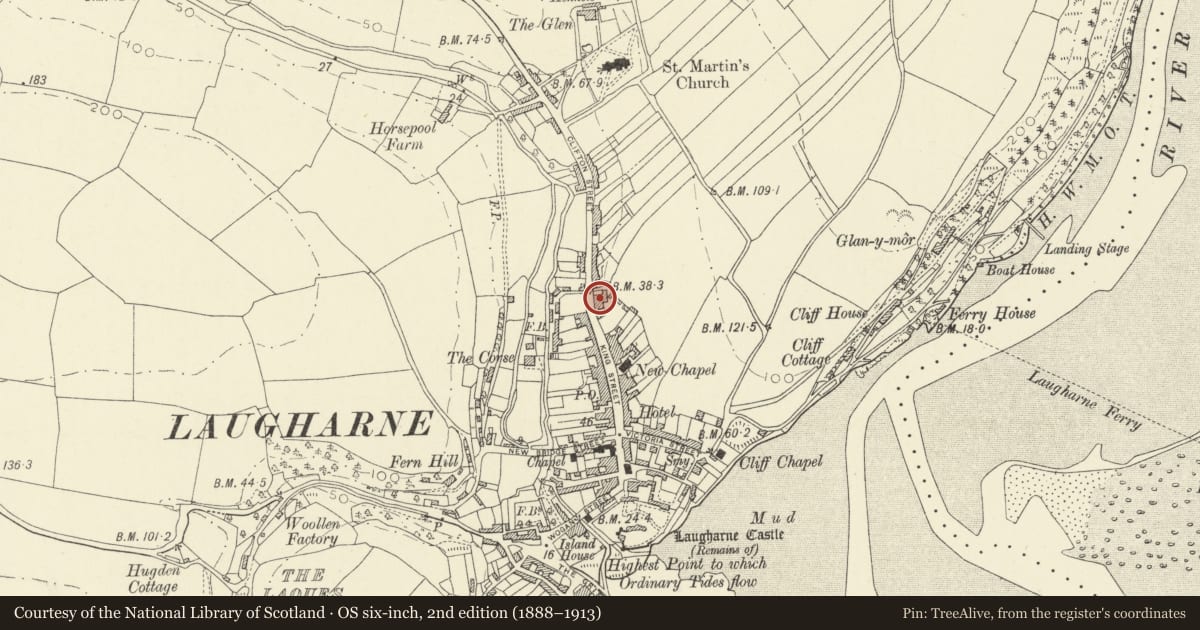
5 historical maps cover this location, the earliest the 1636 map "Cornubia : Devonia, Somersetus, Dorcestria, Wiltonia, Glocestria ..." (David Rumsey Map Collection, Stanford Libraries).
Historical maps covering this location
- 1636 · Cornubia : Devonia, Somersetus, Dorcestria, Wiltonia, Glocestria ... (David Rumsey Map Collection, Stanford Libraries)
- 1860 · 41. Caermathen. (David Rumsey Map Collection, Stanford Libraries)
- 1891 · Sheet 10. Ordnance Survey of England and Wales. . (David Rumsey Map Collection, Stanford Libraries)
- 1898 · 229 Carmarthen (Hills) (David Rumsey Map Collection, Stanford Libraries)
- 1920 · Sheet 100. Llanelly. (David Rumsey Map Collection, Stanford Libraries)
Cadw's description
Location
Set across the slope at the junction with Clifton Street, reached by ramped and iron railed pavement above the road.
Exterior
Late C18 (said to be dated 1790) Georgian 3-storey and basement 2-window rendered front built with Moir House and known as "Big House", Divided up ca 1900. Slate roof, dentiled eaves; brick chimney stacks, later ro right and with rubble chimney breast to left end wall. 3-light horned sash windows with 4-storey splayed bay to left. Raised central entrance reached by parallel rubble steps, fine open pedimented doorcase with oval paterae to bracketed entablature; 6-panel door, 5-panel petal fanlight. Basement window retained to left, others concealed by raised pavement.
3-storey, 2 window rubble cross range at rear. Various irregularly spaced sash, pivot and casement windows with brick voussoirs to left; porch to panelled door removed, entered from small terrace.
Outbuildings adjoint at rear and rubble wall lines drive to N.
Interior
Interior retains classically detailed fireplace, egg and dart and acanthus cornices, panelled doors etc.
Reason for designation
Group value.
Nearby in the register
- Moir HouseDomesticunder 1 mi
- RosettaDomesticunder 1 mi
- Clifton HouseDomesticunder 1 mi
- Great HouseDomesticunder 1 mi
Other entries of the same register within about three miles of this one, by straight line.