Cof Cymru: National Historic Assets of Wales · Wales
34 Quay Street
Carmarthen, Carmarthenshire, Wales
A Grade II listed building in Carmarthen, Carmarthenshire, designated on 19 May 1981.
The record
- Designation
- Listed building, Grade II
- Broad class
- Domestic
- Date of designation
- 19 May 1981
- Community
- Carmarthen
- Unitary authority
- Carmarthenshire
- Country
- Wales
- Coordinates
- 51.85595, -4.30721
- Cadw reference
- 9567
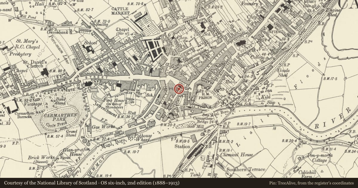
Slide toward Today to fade the historical sheet and see the modern map underneath.
David Rumsey Map Collection, Stanford LibrariesDavid Rumsey Map Collection, Stanford LibrariesDavid Rumsey Map Collection, Stanford LibrariesDavid Rumsey Map Collection, Stanford LibrariesDavid Rumsey Map Collection, Stanford Libraries
5 historical maps cover this location, the earliest the 1636 map "Cornubia : Devonia, Somersetus, Dorcestria, Wiltonia, Glocestria ..." (David Rumsey Map Collection, Stanford Libraries).
Historical maps covering this location
- 1636 · Cornubia : Devonia, Somersetus, Dorcestria, Wiltonia, Glocestria ... (David Rumsey Map Collection, Stanford Libraries)
- 1860 · 41. Caermathen. (David Rumsey Map Collection, Stanford Libraries)
- 1891 · Sheet 10. Ordnance Survey of England and Wales. . (David Rumsey Map Collection, Stanford Libraries)
- 1898 · 229 Carmarthen (Hills) (David Rumsey Map Collection, Stanford Libraries)
- 1901 · Sheet 14. (David Rumsey Map Collection, Stanford Libraries)
Cadw's description
Location
Situated on the junction with St Mary's Street.
History
End terrace house on corner site probably of mid C18 origin, altered in C19. Marked on 1834 map of Carmarthen as an inn. Listed in 1884 as the Union Hall public house, run by Edward Thomas. Offices by early C20.
Exterior
Terraced corner house with elevations to Quay Street and St Mary Street. Painted stucco cladding, with steep imitation-slate roof hipped at corner, boxed eaves and shared stone stack at left end. Two storey and cellar, 3-window range to Quay St, upper floor with 4-pane sash at either end and narrow sash to left of centre; ground floor with C20 4-panel door to left and 4-pane sashes left of centre and right, beneath upper windows. Corner chamfered up to first floor level.
St. Mary's Street elevation with single 4-pane sash to centre right above, 2 similar windows on ground floor, one aligned, one to left. C20 cellar window to right.
Brick stack over eaves in 1981 list now missing, as also left hand cellar opening on Quay St.
Interior
Interior all modernised.
Reason for designation
Included as a Georgian house of more vernacular type than others in Quay Street, in an important corner position.
Nearby in the register
- 33 Quay StreetDomesticunder 1 mi
- 17 Guildhall SquareCommercialunder 1 mi
- The Plume of FeathersCommercialunder 1 mi
- 2 Quay StreetDomesticunder 1 mi
Other entries of the same register within about three miles of this one, by straight line.