Cof Cymru: National Historic Assets of Wales · Wales
Coed Fryn, including railings and gates
Carmarthen, Carmarthenshire, Wales
A Grade II listed building in Carmarthen, Carmarthenshire, designated on 19 May 1981.
The record
- Designation
- Listed building, Grade II
- Broad class
- Domestic
- Date of designation
- 19 May 1981
- Community
- Carmarthen
- Unitary authority
- Carmarthenshire
- Country
- Wales
- Coordinates
- 51.85576, -4.31910
- Cadw reference
- 9536
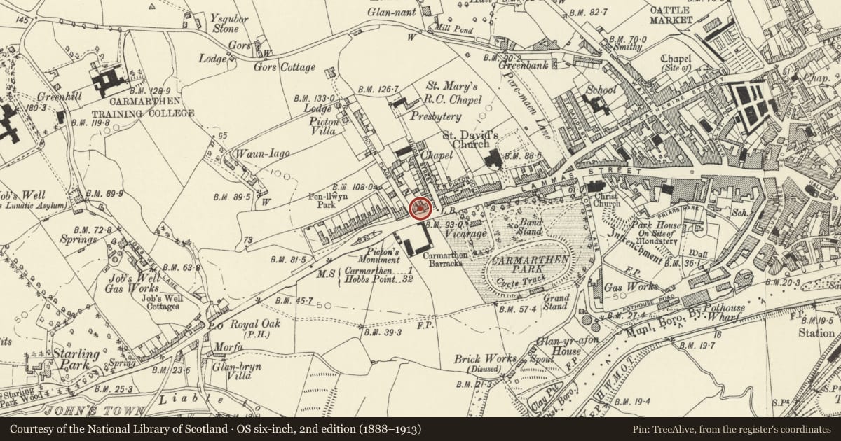
Slide toward Today to fade the historical sheet and see the modern map underneath.
David Rumsey Map Collection, Stanford LibrariesDavid Rumsey Map Collection, Stanford LibrariesDavid Rumsey Map Collection, Stanford LibrariesDavid Rumsey Map Collection, Stanford LibrariesDavid Rumsey Map Collection, Stanford Libraries
5 historical maps cover this location, the earliest the 1636 map "Cornubia : Devonia, Somersetus, Dorcestria, Wiltonia, Glocestria ..." (David Rumsey Map Collection, Stanford Libraries).
Historical maps covering this location
- 1636 · Cornubia : Devonia, Somersetus, Dorcestria, Wiltonia, Glocestria ... (David Rumsey Map Collection, Stanford Libraries)
- 1860 · 41. Caermathen. (David Rumsey Map Collection, Stanford Libraries)
- 1891 · Sheet 10. Ordnance Survey of England and Wales. . (David Rumsey Map Collection, Stanford Libraries)
- 1898 · 229 Carmarthen (Hills) (David Rumsey Map Collection, Stanford Libraries)
- 1901 · Sheet 14. (David Rumsey Map Collection, Stanford Libraries)
Cadw's description
Location
Situated approximately 20m E of junction with Picton Place.
History
Earlier C19 terraced house built after development was initiated by the building of the Picton Monument 1825-8, marked on 1834 map, with large late C19 2-storey bay windows. Set back from, and lower than No 24 but possibly built as a pair with No 26. Said to have been occupied once by Walter Lloyd, chemist at No 12 Lammas Street. Doorcase, wrought-iron railings and gates match others on Picton Terrace, of 1825-35.
Exterior
Terraced house, set back from No.24, painted stucco, with imitation slate roof with renewed small modillion eaves cornice and renewed brick stack to left. Two-storey, 3-window range, all fenestration C20 uPVC. Two-storey late C19 canted bay window each side, each with cornices, the upper one continuous with eaves cornice, plain window above centre arched doorway with panelled reveals and soffit. C20 doorcase, in 1981 with keystone and archivolt, now with minimal open pediment on console brackets over reeded half columns. Four steps up to C20 house door with fanlight with radiating tracery. To extreme right is 6-panel passage door in blind-arched opening.
Front dwarf grey limestone wall and wrought iron railings as on Nos 23 and 24 with scrolled arrow-headed finials rising alternately above top and middle rails; standards with urn finials; centre and right hand gates of similar design, centre gates originally a pair now welded together as one, single gate to right.
Interior
Altered interior, large cellar now single room, formerly 5 rooms. Enclosed C20 stair at right angles on back wall.
Reason for designation
Included despite alterations as a late Georgian house, part of the group in Picton Terrace - a fine late Georgian suburban development.
Nearby in the register
- Porth Angel, including rear garden wall to Picton PlaceDomesticunder 1 mi
- Llwyn Celyn, including railings and gatesDomesticunder 1 mi
- No 23 including railings and gateDomesticunder 1 mi
- No 27 including railings and gates and rear garden wallDomesticunder 1 mi
Other entries of the same register within about three miles of this one, by straight line.