Cof Cymru: National Historic Assets of Wales · Wales
Remains of monastic grange at Penallt Farm
St. Ishmael, Carmarthenshire, Wales
A Grade II listed building in Llansaint, St. Ishmael, Carmarthenshire, designated on 30 November 1966.
The record
- Designation
- Listed building, Grade II
- Broad class
- Religious, Ritual and Funerary
- Date of designation
- 30 November 1966
- Locality
- Llansaint
- Community
- St. Ishmael
- Unitary authority
- Carmarthenshire
- Country
- Wales
- Coordinates
- 51.73866, -4.33612
- Cadw reference
- 9412
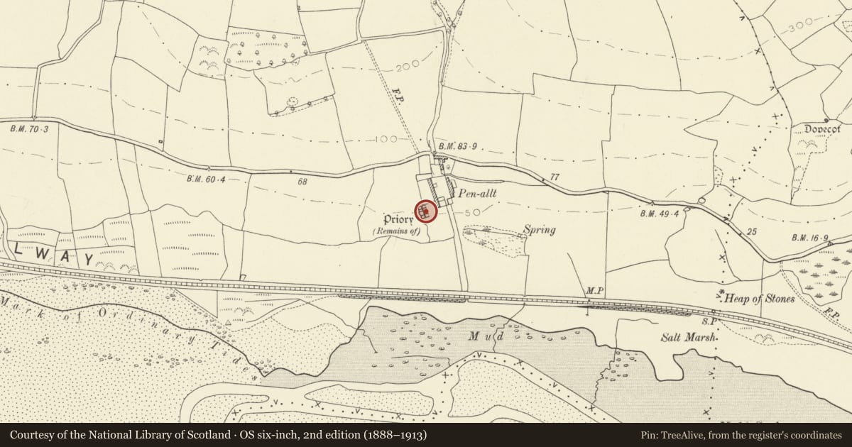
Slide toward Today to fade the historical sheet and see the modern map underneath.
David Rumsey Map Collection, Stanford LibrariesDavid Rumsey Map Collection, Stanford LibrariesDavid Rumsey Map Collection, Stanford LibrariesDavid Rumsey Map Collection, Stanford LibrariesDavid Rumsey Map Collection, Stanford Libraries
5 historical maps cover this location, the earliest the 1636 map "Cornubia : Devonia, Somersetus, Dorcestria, Wiltonia, Glocestria ..." (David Rumsey Map Collection, Stanford Libraries).
Historical maps covering this location
- 1636 · Cornubia : Devonia, Somersetus, Dorcestria, Wiltonia, Glocestria ... (David Rumsey Map Collection, Stanford Libraries)
- 1637 · The fourth table of England. Cornub. Devonia, Somerset etc. (David Rumsey Map Collection, Stanford Libraries)
- 1891 · Sheet 10. Ordnance Survey of England and Wales. . (David Rumsey Map Collection, Stanford Libraries)
- 1898 · 229 Carmarthen (Hills) (David Rumsey Map Collection, Stanford Libraries)
- 1920 · Sheet 100. Llanelly. (David Rumsey Map Collection, Stanford Libraries)
Cadw's description
Location
On the SW side of the farm. Penallt is 1km SSE of Llansaint and on the S side of the Ferryside to Kidwelly road.
History
Probably part of a C16 grange belonging to Kidwelly Priory. Upstanding remains belong to the W side of what was probably originally an L-shaped block.
Exterior
A rubble-stone wall approximately 25m long and up to 6m high, forms the outer W wall of a 2-storey block. A rectangular projection is L of centre, perhaps for a stair, to the L of which are 2 windows in the lower storey with segmental heads, and openings for 4 windows above. To the R of the projection is a doorway and 1st floor corbels, perhaps for a stack. Further R is a single window in the upper storey and doorway near the R end. Behind are return walls and rear wall enclosing rooms, with field walls attached at both ends. Overgrown with ivy at the time of inspection.
Reason for designation
Listed as the ruins of a once substantial monastic grange.
Nearby in the register
- Dovecote NW of Coleman FarmAgriculture and Subsistenceunder 1 mi
- Coleman Dovecotdovecoteunder 1 mi
- Church of All SaintsReligious, Ritual and Funeraryunder 1 mi
- Kidwelly QuayMaritimeunder 1 mi
Other entries of the same register within about three miles of this one, by straight line.