Cof Cymru: National Historic Assets of Wales · Wales
Llandre-Egremont Farmhouse
Clynderwen, Pembrokeshire, Wales
A Grade II listed building in Egremont, Clynderwen, Pembrokeshire, designated on 30 November 1966.
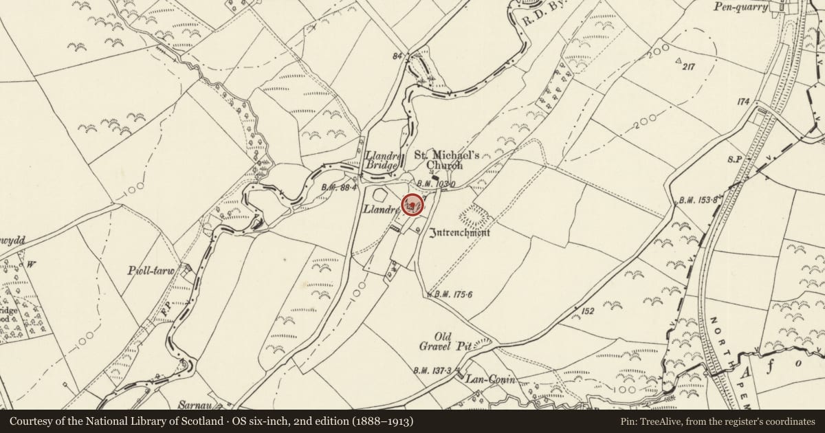
The record
- Designation
- Listed building, Grade II
- Broad class
- Domestic
- Date of designation
- 30 November 1966
- Locality
- Egremont
- Community
- Clynderwen
- Unitary authority
- Pembrokeshire
- Country
- Wales
- Coordinates
- 51.84885, -4.76974
- Cadw reference
- 9398
Slide toward Today to fade the historical sheet and see the modern map underneath.
David Rumsey Map Collection, Stanford LibrariesDavid Rumsey Map Collection, Stanford LibrariesDavid Rumsey Map Collection, Stanford LibrariesDavid Rumsey Map Collection, Stanford LibrariesDavid Rumsey Map Collection, Stanford Libraries
5 historical maps cover this location, the earliest the 1636 map "Cornubia : Devonia, Somersetus, Dorcestria, Wiltonia, Glocestria ..." (David Rumsey Map Collection, Stanford Libraries).
Historical maps covering this location
- 1636 · Cornubia : Devonia, Somersetus, Dorcestria, Wiltonia, Glocestria ... (David Rumsey Map Collection, Stanford Libraries)
- 1830 · V.3:11-15:XV. Britisches Reich. A. Kon: England. b. Frstenthum Wales: Shire: 37-40 (David Rumsey Map Collection, Stanford Libraries)
- 1891 · Sheet 10. Ordnance Survey of England and Wales. . (David Rumsey Map Collection, Stanford Libraries)
- 1898 · 228 Haverfordwest (Hills) (David Rumsey Map Collection, Stanford Libraries)
- 1901 · Sheet 13. (David Rumsey Map Collection, Stanford Libraries)
Cadw's description
Location
Approximately 3km WNW of Clunderwen, reached by private drive on the E side of the B4313.
History
Built in 1788 for John Protheroe (date on building). The rear wing was added in the late C19.
Exterior
A 3-storey 3-window Georgian house of whitened rubble stone and slate roof on brick sawtooth eaves, with stone end stacks. Openings have flat keyed arches, except the upper storey where they are beneath the eaves. The central entrance, with half-glazed panelled door of c1900, is within an added flat-roofed conservatory occupying the centre and R side. Windows are replaced in original openings, except the lower R, inside the conservatory, which has been converted into a doorway. Beneath the sill of the central window in the upper storey is a tablet bearing the date and heraldic achievement in low relief. In the asymmetrical gable ends, the L-hand has 2 inserted windows, the R-hand a replaced window lower L, and a flat-roofed porch to the R. In the gable, on the L side, is a shallow opening said to be for a bell. An added 2-storey rear wing, continuous with the R gable end but separated by a vertical joint, has replaced windows in its side walls. The rear of the main range has replaced windows, and a former doorway lower R also converted to a window.
Reason for designation
Listed, notwithstanding highly visible alterations, as a substantial late Georgian house with good proportions.
Nearby in the register
- Dovecote at Llandre-EgremontNo class recordedunder 1 mi
- Llandre EntrenchmentEnclosureunder 1 mi
- Cleddau Railway Bridge (partly in New Moat Community)No class recordedunder 1 mi
- Longridge Bridge (Partly in New Moat Community)No class recordedunder 1 mi
Other entries of the same register within about three miles of this one, by straight line.