Cof Cymru: National Historic Assets of Wales · Wales
Dovecote at Llandre-Egremont
Clynderwen, Pembrokeshire, Wales
A Grade II listed building in Egremont, Clynderwen, Pembrokeshire, designated on 10 April 2004.
The record
- Designation
- Listed building, Grade II
- Broad class
- No class recorded
- Date of designation
- 10 April 2004
- Locality
- Egremont
- Community
- Clynderwen
- Unitary authority
- Pembrokeshire
- Country
- Wales
- Coordinates
- 51.84878, -4.76995
- Cadw reference
- 82465
Slide toward Today to fade the historical sheet and see the modern map underneath.
David Rumsey Map Collection, Stanford LibrariesDavid Rumsey Map Collection, Stanford LibrariesDavid Rumsey Map Collection, Stanford LibrariesDavid Rumsey Map Collection, Stanford LibrariesDavid Rumsey Map Collection, Stanford Libraries
5 historical maps cover this location, the earliest the 1636 map "Cornubia : Devonia, Somersetus, Dorcestria, Wiltonia, Glocestria ..." (David Rumsey Map Collection, Stanford Libraries).
Historical maps covering this location
- 1636 · Cornubia : Devonia, Somersetus, Dorcestria, Wiltonia, Glocestria ... (David Rumsey Map Collection, Stanford Libraries)
- 1830 · V.3:11-15:XV. Britisches Reich. A. Kon: England. b. Frstenthum Wales: Shire: 37-40 (David Rumsey Map Collection, Stanford Libraries)
- 1891 · Sheet 10. Ordnance Survey of England and Wales. . (David Rumsey Map Collection, Stanford Libraries)
- 1898 · 228 Haverfordwest (Hills) (David Rumsey Map Collection, Stanford Libraries)
- 1901 · Sheet 13. (David Rumsey Map Collection, Stanford Libraries)
Cadw's description
Location
On the SW side of the house.
History
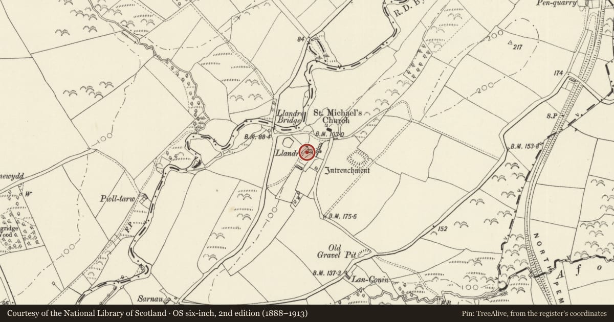
The house was built in the C18. The dovecote was built later, possibly as late as the mid C19 as it is not shown on the 1844 Tithe map, but is shown on the 1891 Ordnance Survey.
Exterior
A 2-storey dovecote of coursed rubble stone and pyramidal slate roof with apex weathervane. The front, facing NE, has a keyed, pointed doorway with replaced door and small-pane overlight. Flanking pointed windows, with original sills raised, incorporate diamond-pane glazing. In the upper storey is a replaced Venetian window with sill and impost bands. The NW side has a replaced pointed window in the lower storey and upper-storey opening with mesh. Pigeon holes, with ledges, are on the SE side, with further bur fewer holes to the SW.
Reason for designation
Listed for its special architectural interest as a C19 building of definite quality and character, and for group value with the house.
Nearby in the register
- Llandre-Egremont FarmhouseDomesticunder 1 mi
- Llandre EntrenchmentEnclosureunder 1 mi
- Cleddau Railway Bridge (partly in New Moat Community)No class recordedunder 1 mi
- Longridge Bridge (Partly in New Moat Community)No class recordedunder 1 mi
Other entries of the same register within about three miles of this one, by straight line.