Cof Cymru: National Historic Assets of Wales · Wales
Capel Bigawdin
Llanddarog, Carmarthenshire, Wales
A Grade II* listed building in Porthyrhyd, Llanddarog, Carmarthenshire, designated on 30 November 1966.
The record
- Designation
- Listed building, Grade II*
- Broad class
- Religious, Ritual and Funerary
- Date of designation
- 30 November 1966
- Locality
- Porthyrhyd
- Community
- Llanddarog
- Unitary authority
- Carmarthenshire
- Country
- Wales
- Coordinates
- 51.81119, -4.16054
- Cadw reference
- 9395
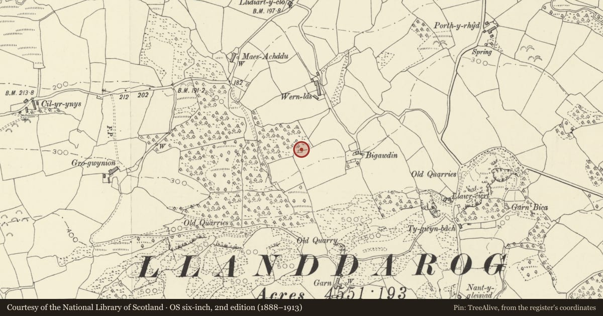
Slide toward Today to fade the historical sheet and see the modern map underneath.
David Rumsey Map Collection, Stanford LibrariesDavid Rumsey Map Collection, Stanford LibrariesDavid Rumsey Map Collection, Stanford LibrariesDavid Rumsey Map Collection, Stanford LibrariesDavid Rumsey Map Collection, Stanford Libraries
5 historical maps cover this location, the earliest the 1636 map "Cornubia : Devonia, Somersetus, Dorcestria, Wiltonia, Glocestria ..." (David Rumsey Map Collection, Stanford Libraries).
Historical maps covering this location
- 1636 · Cornubia : Devonia, Somersetus, Dorcestria, Wiltonia, Glocestria ... (David Rumsey Map Collection, Stanford Libraries)
- 1830 · V.3:11-15:XV. Britisches Reich. A. Kon: England. b. Frstenthum Wales: Shire: 37-40 (David Rumsey Map Collection, Stanford Libraries)
- 1860 · 41. Caermathen. (David Rumsey Map Collection, Stanford Libraries)
- 1891 · Sheet 10. Ordnance Survey of England and Wales. . (David Rumsey Map Collection, Stanford Libraries)
- 1901 · Sheet 14. (David Rumsey Map Collection, Stanford Libraries)
Cadw's description
Location
Attached to a field wall S of Wern-las Farm, approximately 2km SE of Llanddarog village.
History
A medieval well chapel mainly of C16 date.
Exterior
Small ruined chapel with a stream flowing through it. Walls are rubble stone, stand to full height in the W and E walls, which retain putlog holes, to half its original height in the N wall, while the S wall acts as a retaining wall to a steep bank. A pointed W doorway is double chamfered. Above it is a 2-light square-headed window with chamfered mullions, in C16 style. A gabled bellcote has partly fallen. Inside, the W wall has a corbelled niche upper-R of the doorway. The N wall also has a small corbelled niche. The E wall retains a window opening but the dressings have been removed.
Reason for designation
Listed grade II* for its exceptional historical interest as a medieval chapel built over a holy well.
Nearby in the register
- Old house, with attached cow house, at Garn FarmNo class recordedunder 1 mi
- Old House at Garn FarmNo class recordedunder 1 mi
- Maesdulais LimekilnsLimekilnunder 1 mi
- Maesdulais Lime KilnsNo class recordedunder 1 mi
Other entries of the same register within about three miles of this one, by straight line.