Cof Cymru: National Historic Assets of Wales · Wales
Old House at Garn Farm
Llanddarog, Carmarthenshire, Wales
A Grade II listed building in Garn, Llanddarog, Carmarthenshire, designated on 12 December 2003.
The record
- Designation
- Listed building, Grade II
- Broad class
- No class recorded
- Date of designation
- 12 December 2003
- Locality
- Garn
- Community
- Llanddarog
- Unitary authority
- Carmarthenshire
- Country
- Wales
- Coordinates
- 51.80765, -4.15888
- Cadw reference
- 82280
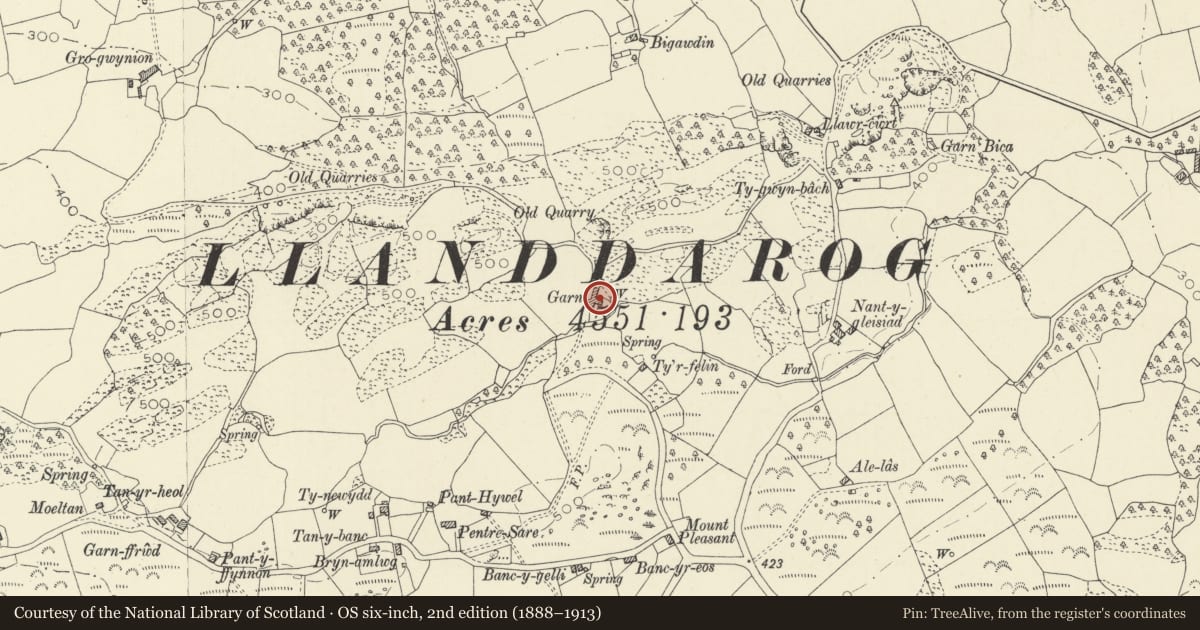
Slide toward Today to fade the historical sheet and see the modern map underneath.
David Rumsey Map Collection, Stanford LibrariesDavid Rumsey Map Collection, Stanford LibrariesDavid Rumsey Map Collection, Stanford LibrariesDavid Rumsey Map Collection, Stanford LibrariesDavid Rumsey Map Collection, Stanford Libraries
5 historical maps cover this location, the earliest the 1636 map "Cornubia : Devonia, Somersetus, Dorcestria, Wiltonia, Glocestria ..." (David Rumsey Map Collection, Stanford Libraries).
Historical maps covering this location
- 1636 · Cornubia : Devonia, Somersetus, Dorcestria, Wiltonia, Glocestria ... (David Rumsey Map Collection, Stanford Libraries)
- 1830 · V.3:11-15:XV. Britisches Reich. A. Kon: England. b. Frstenthum Wales: Shire: 37-40 (David Rumsey Map Collection, Stanford Libraries)
- 1860 · 41. Caermathen. (David Rumsey Map Collection, Stanford Libraries)
- 1891 · Sheet 10. Ordnance Survey of England and Wales. . (David Rumsey Map Collection, Stanford Libraries)
- 1901 · Sheet 14. (David Rumsey Map Collection, Stanford Libraries)
Cadw's description
Location
On the E side of the farmyard, immediately E of the old house with cow house.
History
Probably C17 or C18 and perhaps a secondary dwelling alongside the slightly larger main house. It was later used as a cow house. A new farmhouse was built c1912, although the building may not have been used as a dwelling by that time.
Exterior
A 1½-storey former house of rubble stone and slate roof. It has a doorway offset L of centre with replaced door, flanked by small windows. A stack in the R gable end, and a corbelled stack in the L gable end, have both been cut down below the ridge. The rear has 2 inserted cow-house doorways with boarded doors.
Interior
The interior was converted to a cow house with concrete stalls. All original features have been removed and the walls plastered. The roof has replaced sawn trusses.
Reason for designation
Listed for group value together with the old house with attached cow house.
Nearby in the register
- Old house, with attached cow house, at Garn FarmNo class recordedunder 1 mi
- Capel BigawdinReligious, Ritual and Funeraryunder 1 mi
- Maesdulais Lime KilnsNo class recordedunder 1 mi
- Maesdulais LimekilnsLimekilnunder 1 mi
Other entries of the same register within about three miles of this one, by straight line.