Cof Cymru: National Historic Assets of Wales · Wales
Larch Grove
Penybont, Powys, Wales
A Grade II listed building in Llandegley, Penybont, Powys, designated on 11 August 1993.
The record
- Designation
- Listed building, Grade II
- Broad class
- Domestic
- Date of designation
- 11 August 1993
- Locality
- Llandegley
- Community
- Penybont
- Unitary authority
- Powys
- Country
- Wales
- Coordinates
- 52.24534, -3.25498
- Cadw reference
- 9313
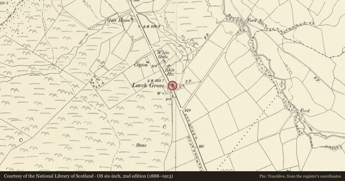
Slide toward Today to fade the historical sheet and see the modern map underneath.
David Rumsey Map Collection, Stanford LibrariesDavid Rumsey Map Collection, Stanford LibrariesDavid Rumsey Map Collection, Stanford LibrariesDavid Rumsey Map Collection, Stanford LibrariesDavid Rumsey Map Collection, Stanford Libraries
5 historical maps cover this location, the earliest the 1608 map "(13) Cambriae Typus." (David Rumsey Map Collection, Stanford Libraries).
Historical maps covering this location
- 1608 · (13) Cambriae Typus. (David Rumsey Map Collection, Stanford Libraries)
- 1637 · Particular description of Wales. Cambria seu Wallia (David Rumsey Map Collection, Stanford Libraries)
- 1883 · Watershed map England, Wales 3. (David Rumsey Map Collection, Stanford Libraries)
- 1899 · 180 Knighton (Hills) (David Rumsey Map Collection, Stanford Libraries)
- 1901 · Sheet 14. (David Rumsey Map Collection, Stanford Libraries)
Cadw's description
Location
Situated by roadside about 1.2km (0.75 mile) SW of Llandegley village on E side of main road.
History
Early C19.
Exterior
Long low range with rear lean-tos. Formerly a roadside inn known as The Drover's Arms. The range includes cottage, stables, cowhouses and a barn under a single roof line. Two storeys, painted rubble stone, some breeze block patching and blocked openings, slate roof. Dairy lean-to behind cottage is also in stone, other additions are stud and weatherboards. Two brick stacks. Front porch stone/slate, open-fronted, boarded front door with strap hinges. Various small-paned casement windows of C19/C20 date. Boarded stable/cowhouse doors, tall double boarded doors to barn.
Interior
Exposed plain squared beams and joists, flagged floors Main room has moulded bressumer above partially-reduced fireplace opening; smaller room has C19 cast-iron fire grate and panelled alcove cupboard. The rooms above the stables are plastered and were used for accommodation.
Reason for designation
Listed as a long range by roadside with considerable vernacular character.
Nearby in the register
- Milestone by roadside on N side of farm road to LlanlogginTransportunder 1 mi
- Milestone on grass verge opposite Corn HillTransportunder 1 mi
- Llandegley Rocks hillfortHillfortunder 1 mi
- L Plan Farm Ranges to NW of Little TrewernAgriculture and Subsistenceunder 1 mi
Other entries of the same register within about three miles of this one, by straight line.