Cof Cymru: National Historic Assets of Wales · Wales
Lane Cottage
Llanfihangel Rhydithon, Powys, Wales
A Grade II listed building in Tan House, Llanfihangel Rhydithon, Powys, designated on 17 June 1993.
The record
- Designation
- Listed building, Grade II
- Broad class
- Domestic
- Date of designation
- 17 June 1993
- Locality
- Tan House
- Community
- Llanfihangel Rhydithon
- Unitary authority
- Powys
- Country
- Wales
- Coordinates
- 52.29792, -3.22579
- Cadw reference
- 9289
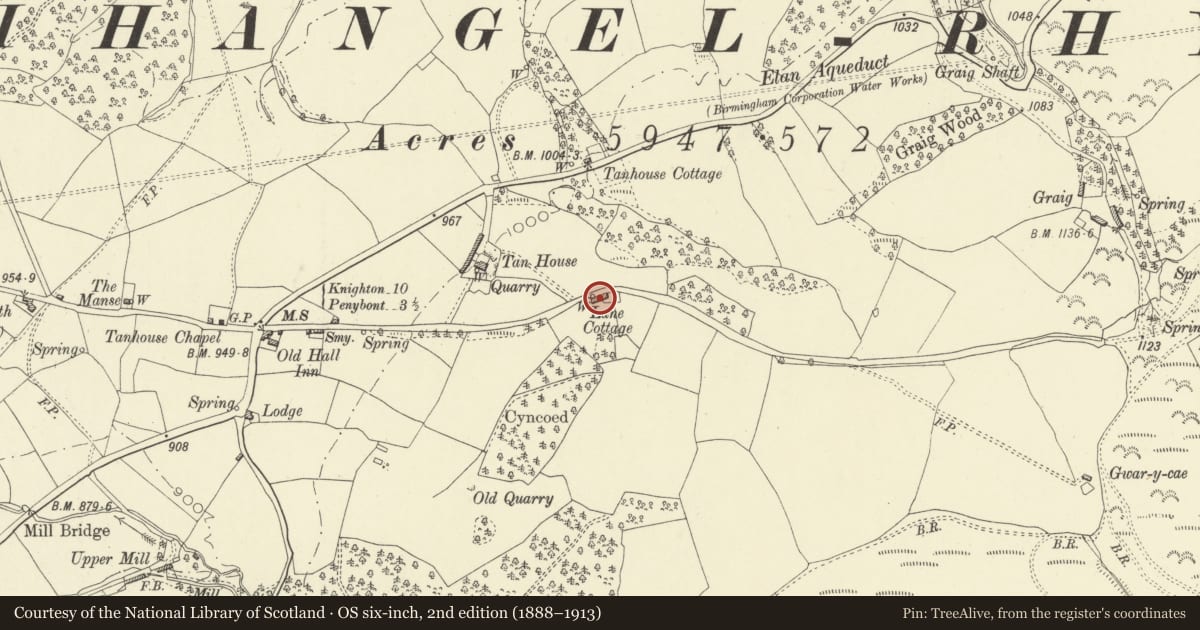
Slide toward Today to fade the historical sheet and see the modern map underneath.
David Rumsey Map Collection, Stanford LibrariesDavid Rumsey Map Collection, Stanford LibrariesDavid Rumsey Map Collection, Stanford LibrariesDavid Rumsey Map Collection, Stanford LibrariesDavid Rumsey Map Collection, Stanford Libraries
5 historical maps cover this location, the earliest the 1608 map "(13) Cambriae Typus." (David Rumsey Map Collection, Stanford Libraries).
Historical maps covering this location
- 1608 · (13) Cambriae Typus. (David Rumsey Map Collection, Stanford Libraries)
- 1637 · Particular description of Wales. Cambria seu Wallia (David Rumsey Map Collection, Stanford Libraries)
- 1883 · Watershed map England, Wales 3. (David Rumsey Map Collection, Stanford Libraries)
- 1899 · 180 Knighton (Hills) (David Rumsey Map Collection, Stanford Libraries)
- 1901 · Sheet 14. (David Rumsey Map Collection, Stanford Libraries)
Cadw's description
Location
Lies 500m east of Tan House crossroads, sited east-west downslope, fronting steep lane rising up Graig Hill.
Exterior
Probably C18, reputedly a Drovers Inn, modernised in recent years including new roof slates, windows and stairs. Two storeys, coursed rubble stone, overpainted. Traces of blocked doors, windows and former building lines can be discerned. Single-storey bay at west end. Single range, tall rubble lateral stack on north side with brick upper, low brick ridge stack to left of centre. Boarded doors, irregular arrangement of windows, mainly small-paned in modern timber-frames. Remains of footings of bay attached to upper end.
Interior
Not easy to interpret but appears to incorporate part of a two-room dwelling at the upper end. Large internal stack, fireplace with chamfered timber lintel, step stop and neat rubble jambs, brick bread oven. The lower end may have been converted from outbuildings. Stud-wall partitions with diagonal bracing, incorporating re-used timbers. Central room has axial chamfered beam.
Reason for designation
This example of a regional cottage, though modernised, retains much of its vernacular character.
Nearby in the register
- Telephone Call-box set into grass verge close to Tan House ChapelCommunicationsunder 1 mi
- Milestone Set into grass verge at N side of CrossroadsTransportunder 1 mi
- Tan House ChapelReligious, Ritual and Funeraryunder 1 mi
- Graig FarmhouseDomesticunder 1 mi
Other entries of the same register within about three miles of this one, by straight line.