Cof Cymru: National Historic Assets of Wales · Wales
L-Plan Farm Ranges to N of the Bryn
New Radnor, Powys, Wales
A Grade II listed building in The Smatcher, New Radnor, Powys, designated on 29 April 1993.
The record
- Designation
- Listed building, Grade II
- Broad class
- Agriculture and Subsistence
- Date of designation
- 29 April 1993
- Locality
- The Smatcher
- Community
- New Radnor
- Unitary authority
- Powys
- Country
- Wales
- Coordinates
- 52.23298, -3.14226
- Cadw reference
- 9265
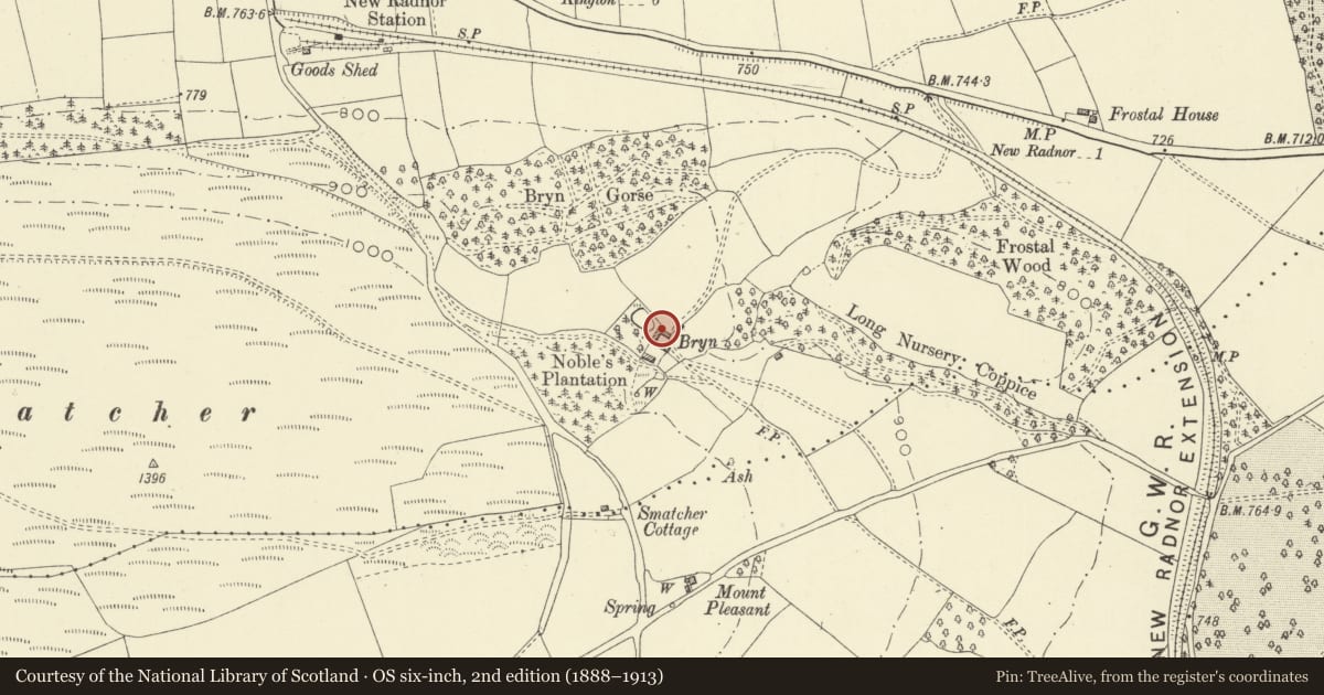
Slide toward Today to fade the historical sheet and see the modern map underneath.
David Rumsey Map Collection, Stanford LibrariesDavid Rumsey Map Collection, Stanford LibrariesDavid Rumsey Map Collection, Stanford LibrariesDavid Rumsey Map Collection, Stanford LibrariesDavid Rumsey Map Collection, Stanford Libraries
5 historical maps cover this location, the earliest the 1608 map "(13) Cambriae Typus." (David Rumsey Map Collection, Stanford Libraries).
Historical maps covering this location
- 1608 · (13) Cambriae Typus. (David Rumsey Map Collection, Stanford Libraries)
- 1636 · Cornubia : Devonia, Somersetus, Dorcestria, Wiltonia, Glocestria ... (David Rumsey Map Collection, Stanford Libraries)
- 1637 · Particular description of Wales. Cambria seu Wallia (David Rumsey Map Collection, Stanford Libraries)
- 1883 · Watershed map England, Wales 3. (David Rumsey Map Collection, Stanford Libraries)
- 1901 · Sheet 14. (David Rumsey Map Collection, Stanford Libraries)
Cadw's description
Location
Lies 0.75km south-east of New Radnor on northern slope of The Smatcher.
Exterior
Mid C19 (?) or perhaps refacing of earlier house. Two storeys, coursed rubble, stone slate roof, half-hipped to right, tall brick stack to left end and rear lateral stack. Brick and slate lean-to housing wash-house at right-hand end. Orderly window arrangement, ground-floor openings under cambered voussoir heads, all chamfered, transomed frames with iron-bar glazing and central opening casement. First-floor windows, three-light iron casements with chamfered frames. Panelled front door, hipped slated porch canopy on chamfered posts.
Outbuildings: L-plan range 25m north of the farmhouse incorporating a four-bay barn and lofted cowhouse. High rubble base walls, stud framework uppers with weatherboarding, slate and corrugated iron roofs. Contemporary with the farmhouse.
Interior
Single-pile plan with central stairs between parlour and kitchen; end bay houses back-stairs and dairy with two salting slabs. Kitchen and dairy end have scroll-stopped beams, parlour has straight-cut stopped beam. Flagstone floors, boarded doors with strap-hinges.
Nearby in the register
- BrynDomesticunder 1 mi
- Former Station Building at New Radnor, including adjacent PlatformTransportunder 1 mi
- Former Goods Shed at New Radnor StationTransportunder 1 mi
- The GroveDomesticunder 1 mi
Other entries of the same register within about three miles of this one, by straight line.