Cof Cymru: National Historic Assets of Wales · Wales
The Grove
New Radnor, Powys, Wales
A Grade II listed building in Grove Bridge, New Radnor, Powys, designated on 29 April 1993.
The record
- Designation
- Listed building, Grade II
- Broad class
- Domestic
- Date of designation
- 29 April 1993
- Locality
- Grove Bridge
- Community
- New Radnor
- Unitary authority
- Powys
- Country
- Wales
- Coordinates
- 52.23872, -3.15206
- Cadw reference
- 9215
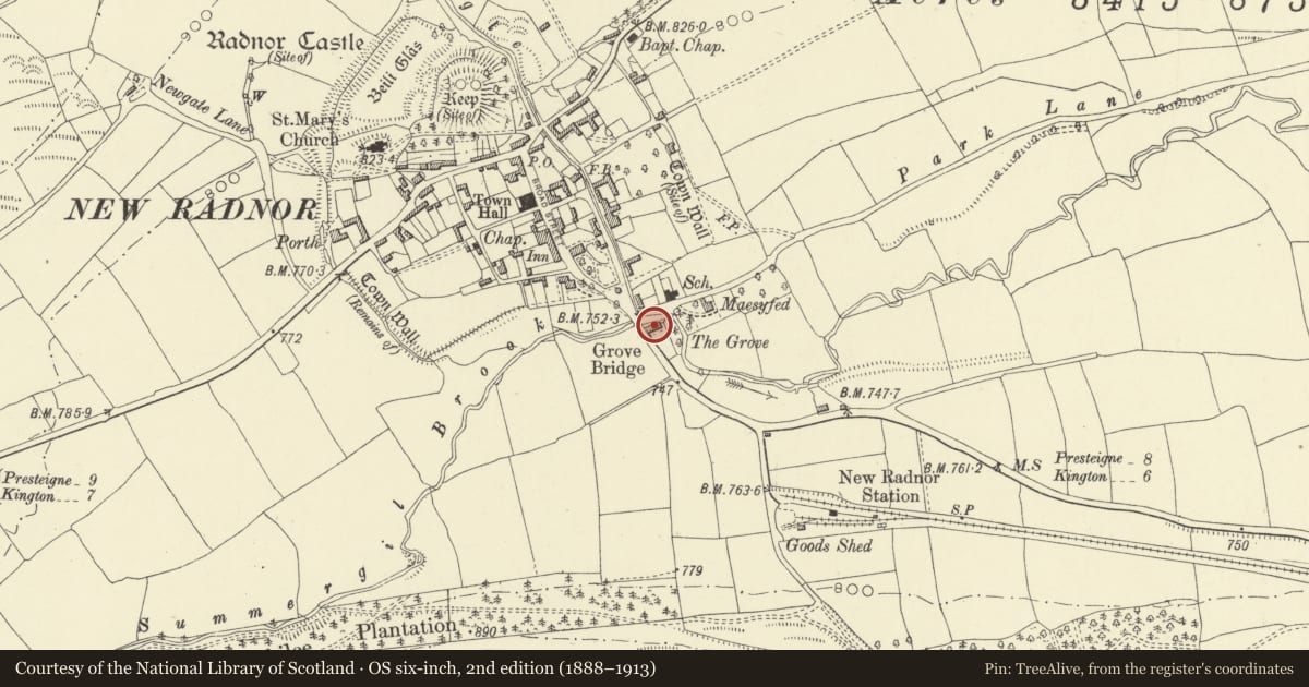
Slide toward Today to fade the historical sheet and see the modern map underneath.
David Rumsey Map Collection, Stanford LibrariesDavid Rumsey Map Collection, Stanford LibrariesDavid Rumsey Map Collection, Stanford LibrariesDavid Rumsey Map Collection, Stanford LibrariesDavid Rumsey Map Collection, Stanford Libraries
5 historical maps cover this location, the earliest the 1608 map "(13) Cambriae Typus." (David Rumsey Map Collection, Stanford Libraries).
Historical maps covering this location
- 1608 · (13) Cambriae Typus. (David Rumsey Map Collection, Stanford Libraries)
- 1637 · Particular description of Wales. Cambria seu Wallia (David Rumsey Map Collection, Stanford Libraries)
- 1883 · Watershed map England, Wales 3. (David Rumsey Map Collection, Stanford Libraries)
- 1899 · 180 Knighton (Hills) (David Rumsey Map Collection, Stanford Libraries)
- 1901 · Sheet 14. (David Rumsey Map Collection, Stanford Libraries)
Cadw's description
Location
Situated on the east side of B4372 just south of the Summergil Brook.
Exterior
Mid C19, two-storey detached house. Lower two-storey service range adjoins to left and single-storey wash-house adjoins to right. Coursed rubble blocks with low plinth, slate roofs, boxed eaves, two brick end stacks. Central, part-glazed door to south (garden) front with plain doorcase, pediment and over-light. Ground-floor windows are later in date with canted bays having fine margin-glazing. First-floor windows are twelve-pane sashes under flat voussoir lintels. Rear elevation has variety of windows including some original three-light iron-framed casements under similar flat lintels, also tall round-headed stair-light with fan tracery. The richly moulded six-panel door in the rear wall is re-used from elsewhere. Roof lights and dormers are modern.
Interior
Staircase with curtail steps, scroll newel, ramped, rounded handrail and stick balusters. Some six-panel doors.
Nearby in the register
- Monument to Sir George Cornewall LewisCommemorativeunder 1 mi
- The Old RectoryDomesticunder 1 mi
- The LaurelsDomesticunder 1 mi
- Yew Tree CottageDomesticunder 1 mi
Other entries of the same register within about three miles of this one, by straight line.