Cof Cymru: National Historic Assets of Wales · Wales
Ferndale
New Radnor, Powys, Wales
A Grade II listed building in Knowle Hill, New Radnor, Powys, designated on 29 April 1993.
The record
- Designation
- Listed building, Grade II
- Broad class
- Domestic
- Date of designation
- 29 April 1993
- Locality
- Knowle Hill
- Community
- New Radnor
- Unitary authority
- Powys
- Country
- Wales
- Coordinates
- 52.25483, -3.14244
- Cadw reference
- 9253
Slide toward Today to fade the historical sheet and see the modern map underneath.
David Rumsey Map Collection, Stanford LibrariesDavid Rumsey Map Collection, Stanford LibrariesDavid Rumsey Map Collection, Stanford LibrariesDavid Rumsey Map Collection, Stanford LibrariesDavid Rumsey Map Collection, Stanford Libraries
5 historical maps cover this location, the earliest the 1608 map "(13) Cambriae Typus." (David Rumsey Map Collection, Stanford Libraries).
Historical maps covering this location
- 1608 · (13) Cambriae Typus. (David Rumsey Map Collection, Stanford Libraries)
- 1637 · Particular description of Wales. Cambria seu Wallia (David Rumsey Map Collection, Stanford Libraries)
- 1883 · Watershed map England, Wales 3. (David Rumsey Map Collection, Stanford Libraries)
- 1899 · 180 Knighton (Hills) (David Rumsey Map Collection, Stanford Libraries)
- 1901 · Sheet 14. (David Rumsey Map Collection, Stanford Libraries)
Cadw's description
Location
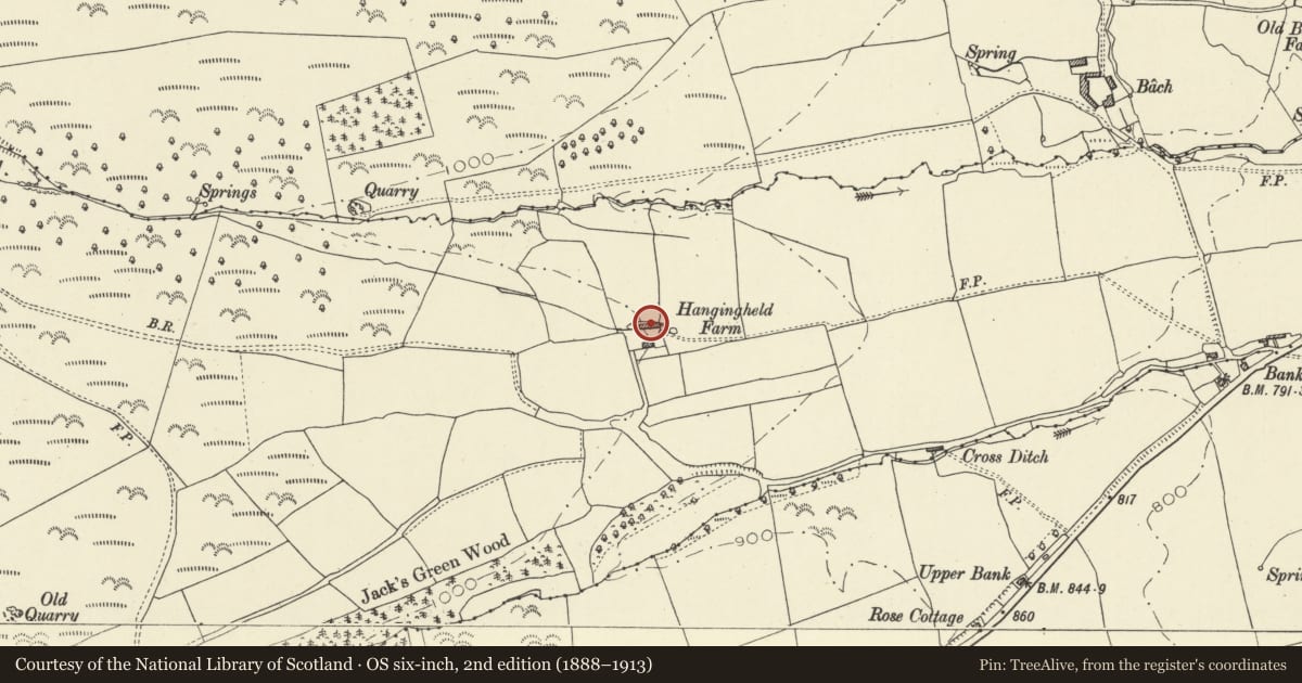
Lies beyond Knowle Hill about 1.5km north east of New Radnor. Formerly known as Hanging Held.
Exterior
Early C19 (pre-1846). Two storeys, rubble stone with plinth (overpainted), slate roof. Two end stacks with rubble uppers. Ground-floor openings under cambered voussoir heads, central door front and back. Front door (garden side) four panels; yard-side door boarded. Ground-floor windows have chamfered frames with transoms and three-light bottom section with iron glazing bars and central opening casement. First floor windows smaller-paned, iron-framed casements.
Lean-to at west end; part rubble, part weatherboarded with slate roof, houses large bread oven and copper.
Interior
Unaltered room-plan and much period detailing. Front parlour and kitchen with central stairs, back kitchen and dairy. Stone flagged floors throughout. Back kitchen has ceiling hooks, dairy has large salting slab on rubble piers.
Nearby in the register
- Farm Range about 30m N of Ferndale FarmhouseAgriculture and Subsistenceunder 1 mi
- Knowle FarmhouseDomesticunder 1 mi
- U-Plan Farm Ranges to W of Knowle FarmhouseAgriculture and Subsistenceunder 1 mi
- U-Plan Ranges of Farm Buildings at Bache FarmAgriculture and Subsistenceunder 1 mi
Other entries of the same register within about three miles of this one, by straight line.