Cof Cymru: National Historic Assets of Wales · Wales
Part of L-Plan Farm Ranges about 20m E.of Downton Farmhouse
New Radnor, Powys, Wales
A Grade II listed building in Downton, New Radnor, Powys, designated on 29 April 1993.
The record
- Designation
- Listed building, Grade II
- Broad class
- Domestic
- Date of designation
- 29 April 1993
- Locality
- Downton
- Community
- New Radnor
- Unitary authority
- Powys
- Country
- Wales
- Coordinates
- 52.23785, -3.12542
- Cadw reference
- 9242
Slide toward Today to fade the historical sheet and see the modern map underneath.
David Rumsey Map Collection, Stanford LibrariesDavid Rumsey Map Collection, Stanford LibrariesDavid Rumsey Map Collection, Stanford LibrariesDavid Rumsey Map Collection, Stanford LibrariesDavid Rumsey Map Collection, Stanford Libraries
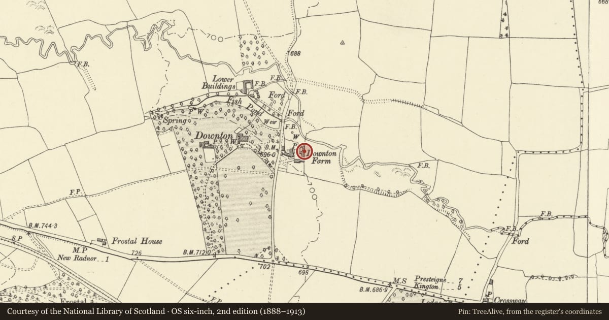
5 historical maps cover this location, the earliest the 1608 map "(13) Cambriae Typus." (David Rumsey Map Collection, Stanford Libraries).
Historical maps covering this location
- 1608 · (13) Cambriae Typus. (David Rumsey Map Collection, Stanford Libraries)
- 1637 · Particular description of Wales. Cambria seu Wallia (David Rumsey Map Collection, Stanford Libraries)
- 1883 · Watershed map England, Wales 3. (David Rumsey Map Collection, Stanford Libraries)
- 1899 · 180 Knighton (Hills) (David Rumsey Map Collection, Stanford Libraries)
- 1901 · Sheet 14. (David Rumsey Map Collection, Stanford Libraries)
Cadw's description
Location
Group of farmbuildings which closes the long E side of farmyard plus cowhouse along S side.
Exterior
Cowhouse: C17? forms south side of range. Two storeys, rubble plinth, weatherboard skin, iron roof, seven boarded doors, boarded loft shutters. Internal inspection not possible but square-panel timber-framing visible where some weatherboards are missing.
Barn: C19, five bays, adjoins north-east corner of cowhouse. Rubble plinth, stud walls with weatherboard skin, slate roof, threshing bay with eaves-height double doors, pegged king-post roof trusses.
Stable: C19, set at right angles to north-west corner of barn. Neat rubble stone, slate roof, stone voussoir flat arches, boarded gable end door, part-glazed window, boarded loft shutter.
Open-fronted cowsheds: C19, adjoins north end of barn. Rubble stone rear wall, slate roof, open bays divided by chamfered timber posts with ogee-moulded eaves brackets.
Reason for designation
Included for group value with the farmhouse.
Nearby in the register
- Part of L-Plan Farm Ranges about 20m E of Downton FarmhouseAgriculture and Subsistenceunder 1 mi
- Part of L-Plan Farm Ranges about 20m E.of Downton FarmhouseAgriculture and Subsistenceunder 1 mi
- Part of L-Plan Farm Ranges about 20m E of Downton FarmhouseAgriculture and Subsistenceunder 1 mi
- Downtown FarmhouseDomesticunder 1 mi
Other entries of the same register within about three miles of this one, by straight line.