Cof Cymru: National Historic Assets of Wales · Wales
Downtown Farmhouse
New Radnor, Powys, Wales
A Grade II listed building in Downton, New Radnor, Powys, designated on 29 April 1993.
The record
- Designation
- Listed building, Grade II
- Broad class
- Domestic
- Date of designation
- 29 April 1993
- Locality
- Downton
- Community
- New Radnor
- Unitary authority
- Powys
- Country
- Wales
- Coordinates
- 52.23782, -3.12589
- Cadw reference
- 9238
Slide toward Today to fade the historical sheet and see the modern map underneath.
David Rumsey Map Collection, Stanford LibrariesDavid Rumsey Map Collection, Stanford LibrariesDavid Rumsey Map Collection, Stanford LibrariesDavid Rumsey Map Collection, Stanford LibrariesDavid Rumsey Map Collection, Stanford Libraries
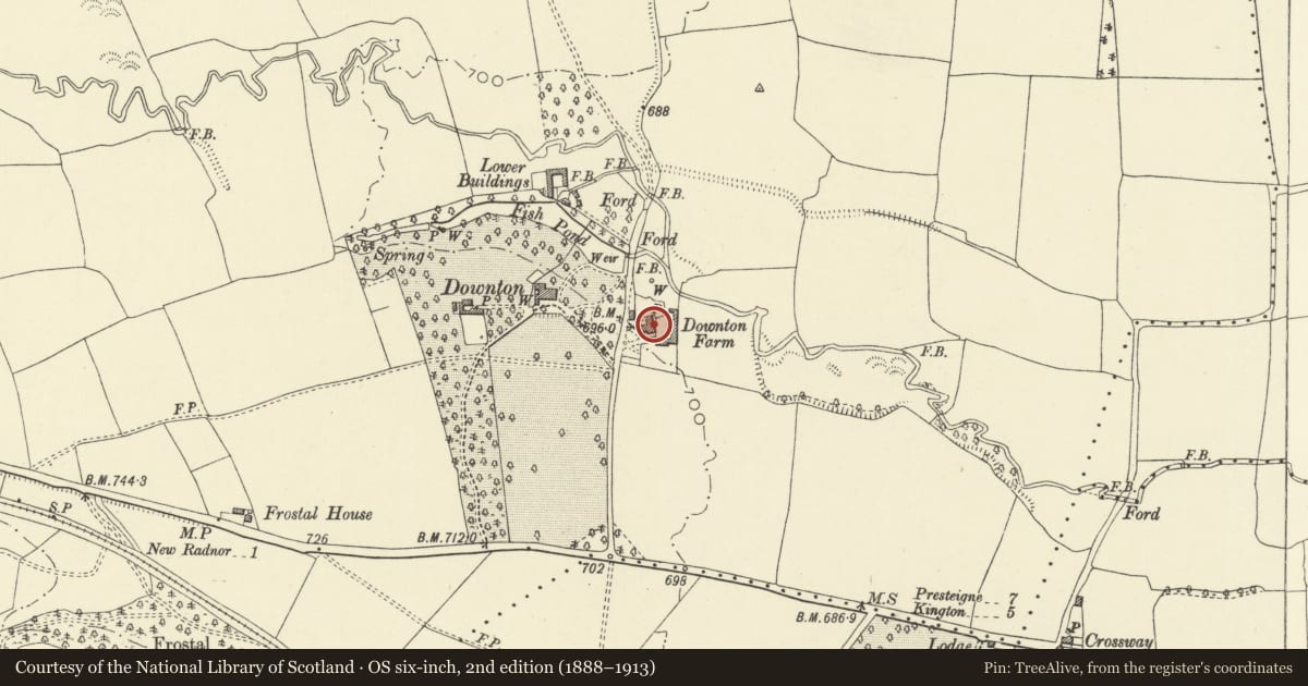
5 historical maps cover this location, the earliest the 1608 map "(13) Cambriae Typus." (David Rumsey Map Collection, Stanford Libraries).
Historical maps covering this location
- 1608 · (13) Cambriae Typus. (David Rumsey Map Collection, Stanford Libraries)
- 1637 · Particular description of Wales. Cambria seu Wallia (David Rumsey Map Collection, Stanford Libraries)
- 1883 · Watershed map England, Wales 3. (David Rumsey Map Collection, Stanford Libraries)
- 1899 · 180 Knighton (Hills) (David Rumsey Map Collection, Stanford Libraries)
- 1901 · Sheet 14. (David Rumsey Map Collection, Stanford Libraries)
Cadw's description
Location
Lies on E side of access road and about 200m to south east of Downton House.
Exterior
Date uncertain (full inspection not possible), possibly C17, the rear (north) portion is the earliest, parallel ranges at the south end are C19. Two storeys, mainly coursed rubble of different phases, the north end has some C18 brickwork and the south front first-floor is also in brick (C19) with ashlar dressings. Slate/stone tile roofs, three tall brick stacks. Open timber porch with chamfered posts and slate roof, framed plank door with overlight. Front windows are tall two-light casements with chamfered frames and large panes. Side windows mainly three-light C19 metal-framed casements under diaper brickwork, cambered lintels. Framed plank side door under similar lintel.
Outbuildings: Adjoining west side of house. L-plan range, weather-boarded with stone tile roof, heavy beamed interior.
Interior
Large flagstone floor throughout, rear portion has chamfered beams and possibly some timber framing; dairy with salting slab, kitchen with large fireplace, bread oven, thick slate window cill and back stairs to former granary and mens' quarters.
Reason for designation
Group value with Downton House and farm outbuildings.
Nearby in the register
- Outbuildings attached to W of Downton FarmhouseAgriculture and Subsistenceunder 1 mi
- Part of L-Plan Farm Ranges about 20m E of Downton FarmhouseAgriculture and Subsistenceunder 1 mi
- Part of L-Plan Farm Ranges about 20m E.of Downton FarmhouseDomesticunder 1 mi
- Part of L-Plan Farm Ranges about 20m E.of Downton FarmhouseAgriculture and Subsistenceunder 1 mi
Other entries of the same register within about three miles of this one, by straight line.