Cof Cymru: National Historic Assets of Wales · Wales
The Forge
New Radnor, Powys, Wales
A Grade II listed building in New Radnor, Powys, designated on 21 September 1962.
The record
- Designation
- Listed building, Grade II
- Broad class
- Industrial
- Date of designation
- 21 September 1962
- Community
- New Radnor
- Unitary authority
- Powys
- Country
- Wales
- Coordinates
- 52.24096, -3.15468
- Cadw reference
- 9216
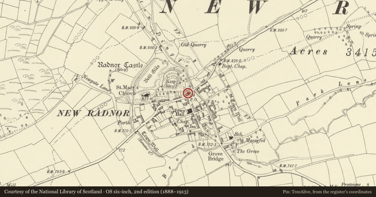
Slide toward Today to fade the historical sheet and see the modern map underneath.
David Rumsey Map Collection, Stanford LibrariesDavid Rumsey Map Collection, Stanford LibrariesDavid Rumsey Map Collection, Stanford LibrariesDavid Rumsey Map Collection, Stanford LibrariesDavid Rumsey Map Collection, Stanford Libraries
5 historical maps cover this location, the earliest the 1608 map "(13) Cambriae Typus." (David Rumsey Map Collection, Stanford Libraries).
Historical maps covering this location
- 1608 · (13) Cambriae Typus. (David Rumsey Map Collection, Stanford Libraries)
- 1637 · Particular description of Wales. Cambria seu Wallia (David Rumsey Map Collection, Stanford Libraries)
- 1883 · Watershed map England, Wales 3. (David Rumsey Map Collection, Stanford Libraries)
- 1899 · 180 Knighton (Hills) (David Rumsey Map Collection, Stanford Libraries)
- 1901 · Sheet 14. (David Rumsey Map Collection, Stanford Libraries)
Cadw's description
Location
Formerly part of 'The Cross Inn' together with No 2, the adjoining property known as 'The Cross'. Facing down Broad Street.
History
C17 in origin, the adjoining forge buildings were added in the latter part of C19.
Exterior
Two storeys, rendered, slate roof, rear section with catslide roof over, 2 rendered end stacks with brick uppers. Central, modern boarded door approached via four steps; flanking small-paned bow windows are modern. C19 iron casements in chamfered timber frames on first-floor.
Blacksmith's Shop: Single-storey with attached stable adjoining the east end of the house. Coursed rubble blocks, slate roof, rubble end stack to smithy. Two-light window with boarded external shutters, boarded doors. Cambered voussoir lintel to smithy door and stable window.
Interior
Shadows of timber framing, chamfered beams.
Interior of smithy unaltered. Large fireplace with raised hearth in massive rubble stack with offsets, slightly arched opening, brick cambered lintel. Smaller fireplace (now blocked) in stack attached to end of house. Single tie-beam truss with king post.
Reason for designation
Group value with No 2 adjoining.
Nearby in the register
- Smithy with Stable attached to No. 1 High StreetDomesticunder 1 mi
- The CrossDomesticunder 1 mi
- Brookside FarmhouseDomesticunder 1 mi
- Rainbow Cottage including shop on rightCommercialunder 1 mi
Other entries of the same register within about three miles of this one, by straight line.