Cof Cymru: National Historic Assets of Wales · Wales
The Laurels
New Radnor, Powys, Wales
A Grade II listed building in New Radnor, Powys, designated on 21 September 1962.
The record
- Designation
- Listed building, Grade II
- Broad class
- Domestic
- Date of designation
- 21 September 1962
- Community
- New Radnor
- Unitary authority
- Powys
- Country
- Wales
- Coordinates
- 52.23965, -3.15357
- Cadw reference
- 9206
Slide toward Today to fade the historical sheet and see the modern map underneath.
David Rumsey Map Collection, Stanford LibrariesDavid Rumsey Map Collection, Stanford LibrariesDavid Rumsey Map Collection, Stanford LibrariesDavid Rumsey Map Collection, Stanford LibrariesDavid Rumsey Map Collection, Stanford Libraries
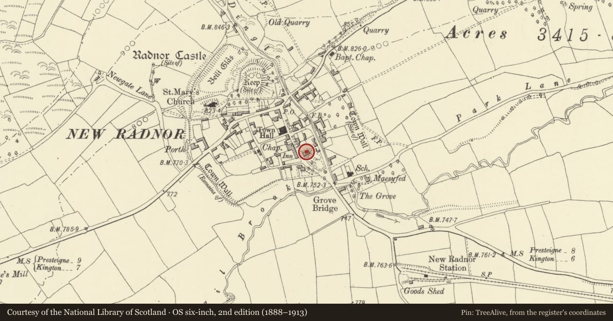
5 historical maps cover this location, the earliest the 1608 map "(13) Cambriae Typus." (David Rumsey Map Collection, Stanford Libraries).
Historical maps covering this location
- 1608 · (13) Cambriae Typus. (David Rumsey Map Collection, Stanford Libraries)
- 1637 · Particular description of Wales. Cambria seu Wallia (David Rumsey Map Collection, Stanford Libraries)
- 1883 · Watershed map England, Wales 3. (David Rumsey Map Collection, Stanford Libraries)
- 1899 · 180 Knighton (Hills) (David Rumsey Map Collection, Stanford Libraries)
- 1901 · Sheet 14. (David Rumsey Map Collection, Stanford Libraries)
Cadw's description
Location
Situated in its own grounds towards the southern end of Broad Street.
Exterior
c1847 (the date of newspaper used as original wall lining, discovered during recent renovations). Two storeys with cellar; small one-and-a-half storey hip-roofed service wing at east end and large conservatory along south side. Small random-sized ashlar blocks with rusticated plinth, tooled ashlar quoins to principal elevations; north elevation of coursed rubble with rubble plinth. Hipped slate roof with central well, boxed eaves paired-flue stacks in brick with ashlar dressings. West (road-side) elevation has two rows of three windows - distinctive arched openings with tooled voussoirs and cills, iron-framed windows with margin glazing and fanlight heads. South (garden) elevation has four similar windows on the first floor, on the ground floor four french windows under flat tooled voussoir heads, one door is a modern replacement. Open fronted entrance porch on north side, part boarded, part glazed with pitched slate roof and decorative pierced bargeboards. Tall round-headed doorway, framed plank door and overlight. Window to left of door round-headed with fan glazing but plain voussoirs. First-floor windows are three-light casements under flat voussoir heads.
Interior
Only partially inspected. Much period detailing including panelled shutters and cupboards, four-panel and six-panel doors, moulded ceiling cornices, closed string stairs with panelled undersides.
Nearby in the register
- Yew Tree CottageDomesticunder 1 mi
- 8 Broad StreetDomesticunder 1 mi
- Station HouseDomesticunder 1 mi
- The NookDomesticunder 1 mi
Other entries of the same register within about three miles of this one, by straight line.