Cof Cymru: National Historic Assets of Wales · Wales
6 Broad Street
New Radnor, Powys, Wales
A Grade II listed building in New Radnor, Powys, designated on 21 September 1962.
The record
- Designation
- Listed building, Grade II
- Broad class
- Domestic
- Date of designation
- 21 September 1962
- Community
- New Radnor
- Unitary authority
- Powys
- Country
- Wales
- Coordinates
- 52.23974, -3.15407
- Cadw reference
- 9207
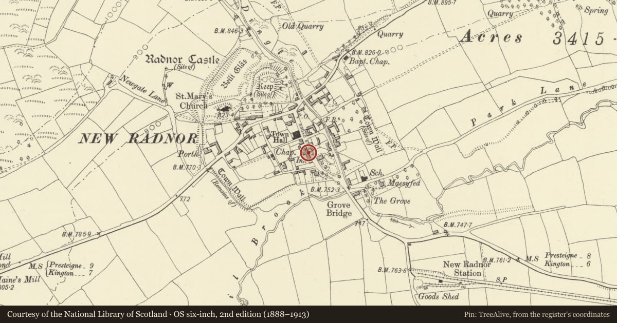
Slide toward Today to fade the historical sheet and see the modern map underneath.
David Rumsey Map Collection, Stanford LibrariesDavid Rumsey Map Collection, Stanford LibrariesDavid Rumsey Map Collection, Stanford LibrariesDavid Rumsey Map Collection, Stanford LibrariesDavid Rumsey Map Collection, Stanford Libraries
5 historical maps cover this location, the earliest the 1608 map "(13) Cambriae Typus." (David Rumsey Map Collection, Stanford Libraries).
Historical maps covering this location
- 1608 · (13) Cambriae Typus. (David Rumsey Map Collection, Stanford Libraries)
- 1637 · Particular description of Wales. Cambria seu Wallia (David Rumsey Map Collection, Stanford Libraries)
- 1883 · Watershed map England, Wales 3. (David Rumsey Map Collection, Stanford Libraries)
- 1899 · 180 Knighton (Hills) (David Rumsey Map Collection, Stanford Libraries)
- 1901 · Sheet 14. (David Rumsey Map Collection, Stanford Libraries)
Cadw's description
Location
Sited in a row running S from Radnor Arms PH.
Exterior
Mid C19. Two storeys (plus one-and-a-half storey lean-to to rear). Coursed squared rubble blocks with band course, low rusticated plinth, boxed eaves, slate roof, brick stacks to left gable and to rear. Distinctive round-arched openings (similar to The Laurels opposite) on ground floor with stipple-tooled voussoirs. Framed plank door with fanlight, two iron-framed ground floor windows with fanlight heads and stone cills. The window on the left is subtly different as it is a later insertion blocking the entrance arch to a former passageway which ran through the building, (following the line of one of the narrow east/west lanes of the C13 street plan). First floor windows are small-paned iron casements in chamfered timber frames under flat voussoir heads.
Interior
Six-panel doors, panelled alcove cupboard.
Reason for designation
Group value with Nos 6 to 10 Broad Street.
Nearby in the register
- The NookDomesticunder 1 mi
- 8 Broad StreetDomesticunder 1 mi
- Station HouseDomesticunder 1 mi
- Yew Tree CottageDomesticunder 1 mi
Other entries of the same register within about three miles of this one, by straight line.