Cof Cymru: National Historic Assets of Wales · Wales
Hindwell Farmhouse
Old Radnor, Powys, Wales
A Grade II listed building in Walton, Old Radnor, Powys, designated on 21 September 1962.
The record
- Designation
- Listed building, Grade II
- Broad class
- Domestic
- Date of designation
- 21 September 1962
- Locality
- Walton
- Community
- Old Radnor
- Unitary authority
- Powys
- Country
- Wales
- Coordinates
- 52.23874, -3.09031
- Cadw reference
- 9193
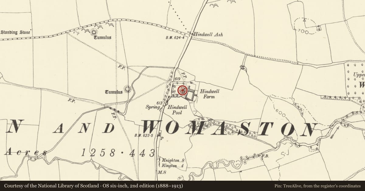
Slide toward Today to fade the historical sheet and see the modern map underneath.
David Rumsey Map Collection, Stanford LibrariesDavid Rumsey Map Collection, Stanford LibrariesDavid Rumsey Map Collection, Stanford LibrariesDavid Rumsey Map Collection, Stanford LibrariesDavid Rumsey Map Collection, Stanford Libraries
5 historical maps cover this location, the earliest the 1608 map "(13) Cambriae Typus." (David Rumsey Map Collection, Stanford Libraries).
Historical maps covering this location
- 1608 · (13) Cambriae Typus. (David Rumsey Map Collection, Stanford Libraries)
- 1637 · Particular description of Wales. Cambria seu Wallia (David Rumsey Map Collection, Stanford Libraries)
- 1883 · Watershed map England, Wales 3. (David Rumsey Map Collection, Stanford Libraries)
- 1899 · 180 Knighton (Hills) (David Rumsey Map Collection, Stanford Libraries)
- 1901 · Sheet 14. (David Rumsey Map Collection, Stanford Libraries)
Cadw's description
History
The house stands between the road and the site of an adjoining Roman fort. It was the home of Thomas Hutchinson and was visited by his sister Mary and brother-in-law William Wordsworth between 1810 and 1812.
Exterior
The C16 (oldest) portion of the house was recently demolished (1985) leaving a double-roofed rear wing of late C17 and a front block of c1800. Two-and-a-half storeys, rendered with exposed rubble plinth, dentil eaves to front block and part of rear wing, hipped roof. Three bays, central 6-panel door with transom light, flat dentil-cornice hood on slender turned columns. Ground-floor windows 18-pane sashes with dropped cills, first-floor 16-pane sashes.
Interior
Only partially inspected. Rear wing contains some late C17 panelling and staircase with barley-twist balusters.
Reason for designation
Group value with farm outbuildings to rear.
Nearby in the register
- L-Plan Range in Farmyard at Hindwell FarmAgriculture and Subsistenceunder 1 mi
- Barn in Farmyard at Hindwell FarmAgriculture and Subsistenceunder 1 mi
- Roman Fort E of Hindwell FarmFortunder 1 mi
- Hindwell palisaded enclosurePalisaded Enclosureunder 1 mi
Other entries of the same register within about three miles of this one, by straight line.