Cof Cymru: National Historic Assets of Wales · Wales
Church of St. Peter
Old Radnor, Powys, Wales
A Grade II listed building in Evenjob, Old Radnor, Powys, designated on 15 February 1993.
The record
- Designation
- Listed building, Grade II
- Broad class
- Religious, Ritual and Funerary
- Date of designation
- 15 February 1993
- Locality
- Evenjob
- Community
- Old Radnor
- Unitary authority
- Powys
- Country
- Wales
- Coordinates
- 52.25745, -3.08163
- Cadw reference
- 9172
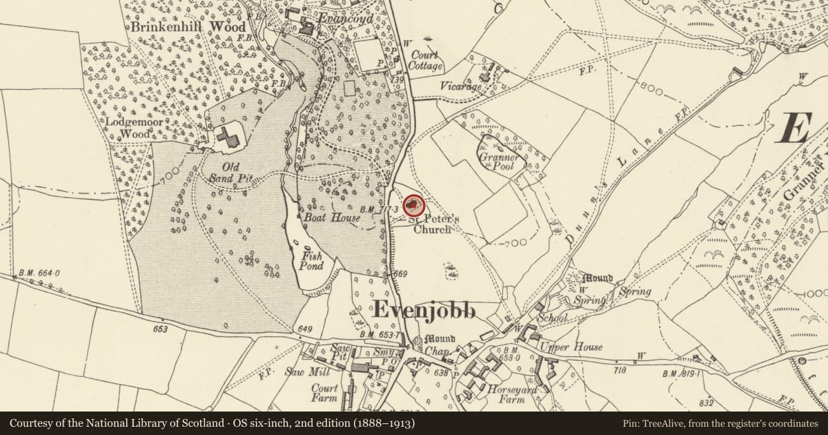
Slide toward Today to fade the historical sheet and see the modern map underneath.
David Rumsey Map Collection, Stanford LibrariesDavid Rumsey Map Collection, Stanford LibrariesDavid Rumsey Map Collection, Stanford LibrariesDavid Rumsey Map Collection, Stanford LibrariesDavid Rumsey Map Collection, Stanford Libraries
5 historical maps cover this location, the earliest the 1608 map "(13) Cambriae Typus." (David Rumsey Map Collection, Stanford Libraries).
Historical maps covering this location
- 1608 · (13) Cambriae Typus. (David Rumsey Map Collection, Stanford Libraries)
- 1637 · Particular description of Wales. Cambria seu Wallia (David Rumsey Map Collection, Stanford Libraries)
- 1883 · Watershed map England, Wales 3. (David Rumsey Map Collection, Stanford Libraries)
- 1899 · 180 Knighton (Hills) (David Rumsey Map Collection, Stanford Libraries)
- 1901 · Sheet 14. (David Rumsey Map Collection, Stanford Libraries)
Cadw's description
Location
Occupying an elevated position about 300m N of Evenjobb village; above the road leading to Whitton.
History
1866-70 by T H Wyatt. Early Decorated style. Snecked sandstone facings, ashlar dressings and steep tiled roofs.
Exterior
Squat proportions to church comprising nave, chancel with lean-to N vestry and angled doorway, S organ-chamber linked to S aisle with porch-tower and broach spire. Coped gables with stone finials, stepped buttresses to angles, polygonal stair turret to SW corner of tower. 3-light traceried E window with Geometric head, similar 2-light windows to W end and N side of nave. Impaled trefoils to traceried lancets, paired cusped lights to S aisle. Paired early C13-style bell-openings with foliage capitals and oculi grouped under superarches. Outer and inner S doorways with nook shafts, hoodmoulds and double boarded inner doors with strapwork hinges.
Interior
Straightforward colourwashed interior with Bath stone (?) dressings. Boarded tunnel roof to chancel with single pointed opening to S organ chamber matched by recess on N wall. E window glass by Clayton and Bell, 1896. Moulded chancel arch with dwarf granite surface on tripartite corbels; fine wrought-iron chancel-screen with crucifix over central "gable", foliage crestings etc. Open nave roof with scissor-arched braces; 2-bay S aisle with dying-back corbels and round pier. Circular stone font with spire cover.
Reason for designation
Included for its prominence in landscape to N of Evenjobb.
Nearby in the register
- The ForgeIndustrialunder 1 mi
- Brook HouseDomesticunder 1 mi
- Courtyard CottagesDomesticunder 1 mi
- Outbuilidng lying 20m SW of Brook HouseDomesticunder 1 mi
Other entries of the same register within about three miles of this one, by straight line.