Cof Cymru: National Historic Assets of Wales · Wales
The Forge
Old Radnor, Powys, Wales
A Grade II listed building in Evenjob, Old Radnor, Powys, designated on 15 February 1993.
The record
- Designation
- Listed building, Grade II
- Broad class
- Industrial
- Date of designation
- 15 February 1993
- Locality
- Evenjob
- Community
- Old Radnor
- Unitary authority
- Powys
- Country
- Wales
- Coordinates
- 52.25464, -3.08194
- Cadw reference
- 9157
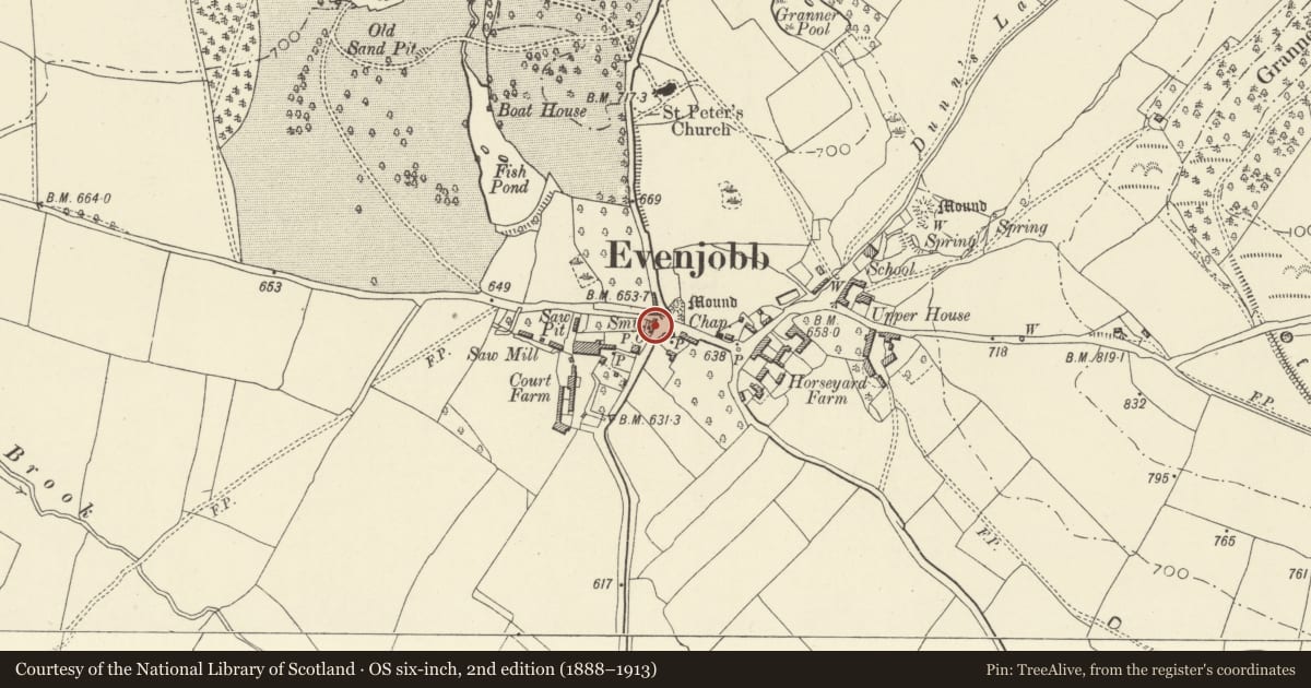
Slide toward Today to fade the historical sheet and see the modern map underneath.
David Rumsey Map Collection, Stanford LibrariesDavid Rumsey Map Collection, Stanford LibrariesDavid Rumsey Map Collection, Stanford LibrariesDavid Rumsey Map Collection, Stanford LibrariesDavid Rumsey Map Collection, Stanford Libraries
5 historical maps cover this location, the earliest the 1608 map "(13) Cambriae Typus." (David Rumsey Map Collection, Stanford Libraries).
Historical maps covering this location
- 1608 · (13) Cambriae Typus. (David Rumsey Map Collection, Stanford Libraries)
- 1637 · Particular description of Wales. Cambria seu Wallia (David Rumsey Map Collection, Stanford Libraries)
- 1883 · Watershed map England, Wales 3. (David Rumsey Map Collection, Stanford Libraries)
- 1899 · 180 Knighton (Hills) (David Rumsey Map Collection, Stanford Libraries)
- 1901 · Sheet 14. (David Rumsey Map Collection, Stanford Libraries)
Cadw's description
Location
Prominent position at village crossroads.
History
Early C19.
Exterior
Two storeys with adjoining lofted stable and single-storey former smithy. Coursed rubble, rendered to left gable, slate roofs, projecting rendered end stack to left with offsets and bake oven; tall brick stack to front right, brick end stack to smithy. Three-window range has small-panel, metal-framed casements, central boarded front door, boarded canopy porch with slate roof. Boarded pitching door and small-paned window to stable loft.
Reason for designation
Group value with Courtyard Cottages opposite.
Nearby in the register
- Courtyard CottagesDomesticunder 1 mi
- Bethel Baptist ChurchReligious, Ritual and Funeraryunder 1 mi
- The HarbourDomesticunder 1 mi
- Telephone Call-box at T-junction in centre of villageCommunicationsunder 1 mi
Other entries of the same register within about three miles of this one, by straight line.