Cof Cymru: National Historic Assets of Wales · Wales
Attached rear outbuilding Range at Horseyard Farm
Old Radnor, Powys, Wales
A Grade II listed building in Evenjob, Old Radnor, Powys, designated on 15 February 1993.
The record
- Designation
- Listed building, Grade II
- Broad class
- Agriculture and Subsistence
- Date of designation
- 15 February 1993
- Locality
- Evenjob
- Community
- Old Radnor
- Unitary authority
- Powys
- Country
- Wales
- Coordinates
- 52.25456, -3.07904
- Cadw reference
- 9165
Slide toward Today to fade the historical sheet and see the modern map underneath.
David Rumsey Map Collection, Stanford LibrariesDavid Rumsey Map Collection, Stanford LibrariesDavid Rumsey Map Collection, Stanford LibrariesDavid Rumsey Map Collection, Stanford LibrariesDavid Rumsey Map Collection, Stanford Libraries
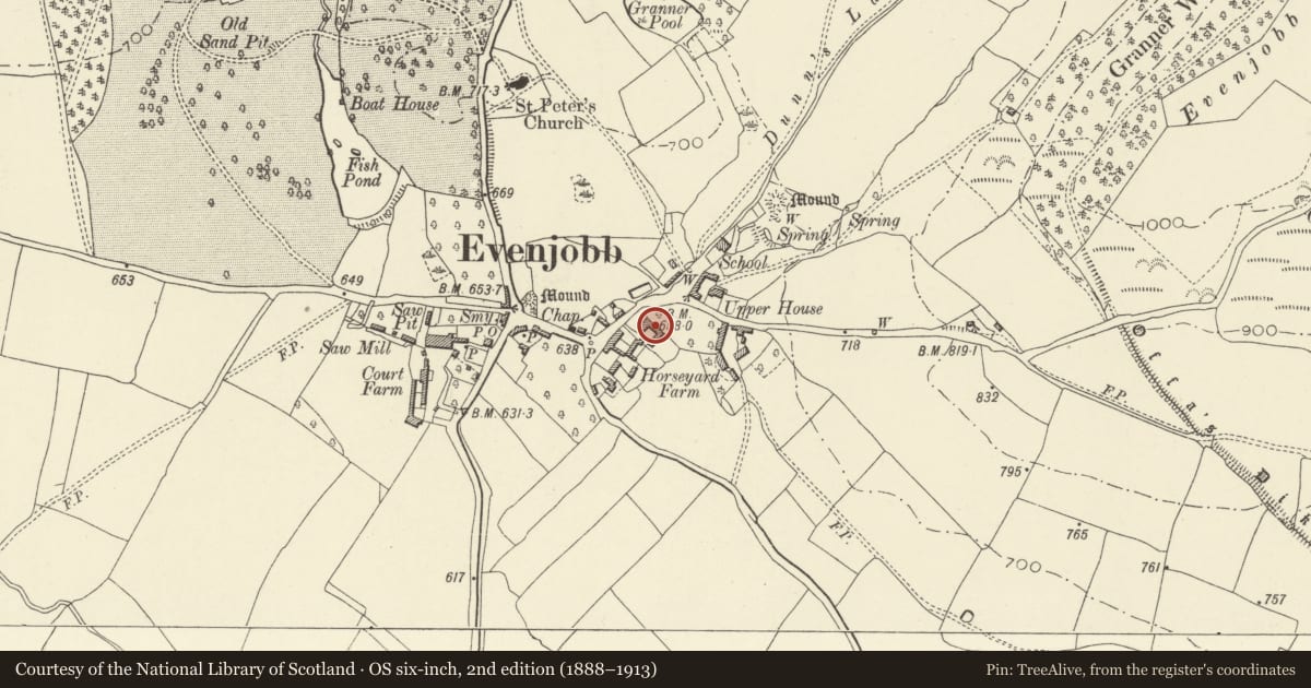
5 historical maps cover this location, the earliest the 1608 map "(13) Cambriae Typus." (David Rumsey Map Collection, Stanford Libraries).
Historical maps covering this location
- 1608 · (13) Cambriae Typus. (David Rumsey Map Collection, Stanford Libraries)
- 1637 · Particular description of Wales. Cambria seu Wallia (David Rumsey Map Collection, Stanford Libraries)
- 1883 · Watershed map England, Wales 3. (David Rumsey Map Collection, Stanford Libraries)
- 1899 · 180 Knighton (Hills) (David Rumsey Map Collection, Stanford Libraries)
- 1901 · Sheet 14. (David Rumsey Map Collection, Stanford Libraries)
Cadw's description
Location
Situated to N of farmyard, close to E side of village centre.
History
Dated 1809, incorporating parts of C18 house at the south end.
Exterior
Two storeys, coursed square rubble, plinth, slate roof hipped to south, rendered ridge stack to right of centre, rubble end stack to north. Windows under flat voussoir lintels with key-block, sixteen-pane sashes except for 2 x 3-light sashes at north end. Six-panel door, projecting doorcase with fluted pilasters, open pediment, panelled reveals and fanlight. Door to left of centre, part boarded, part panelled with small overlight. "1809" carved into first floor lintel keyblock. Rear elevation shows break in building line. Running from south-east corner is later C19 one-and-a-half storey service wing and from the east corner a single-storey range of outbuildings - rubble with iron roof and modern boarded doors. Interior not inspected.
Nearby in the register
- Horseyard FarmhouseDomesticunder 1 mi
- Barn to rear of Horseyard FarmhouseAgriculture and Subsistenceunder 1 mi
- Outbuilidng lying 20m SW of Brook HouseDomesticunder 1 mi
- Lower HouseDomesticunder 1 mi
Other entries of the same register within about three miles of this one, by straight line.