Cof Cymru: National Historic Assets of Wales · Wales
Lower House
Old Radnor, Powys, Wales
A Grade II listed building in Evenjob, Old Radnor, Powys, designated on 13 December 1951.
The record
- Designation
- Listed building, Grade II
- Broad class
- Domestic
- Date of designation
- 13 December 1951
- Locality
- Evenjob
- Community
- Old Radnor
- Unitary authority
- Powys
- Country
- Wales
- Coordinates
- 52.25410, -3.07976
- Cadw reference
- 9163
Slide toward Today to fade the historical sheet and see the modern map underneath.
David Rumsey Map Collection, Stanford LibrariesDavid Rumsey Map Collection, Stanford LibrariesDavid Rumsey Map Collection, Stanford LibrariesDavid Rumsey Map Collection, Stanford LibrariesDavid Rumsey Map Collection, Stanford Libraries
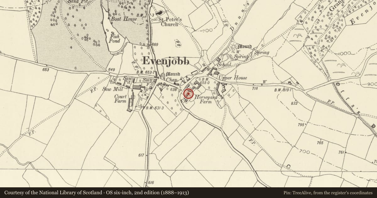
5 historical maps cover this location, the earliest the 1608 map "(13) Cambriae Typus." (David Rumsey Map Collection, Stanford Libraries).
Historical maps covering this location
- 1608 · (13) Cambriae Typus. (David Rumsey Map Collection, Stanford Libraries)
- 1637 · Particular description of Wales. Cambria seu Wallia (David Rumsey Map Collection, Stanford Libraries)
- 1883 · Watershed map England, Wales 3. (David Rumsey Map Collection, Stanford Libraries)
- 1899 · 180 Knighton (Hills) (David Rumsey Map Collection, Stanford Libraries)
- 1901 · Sheet 14. (David Rumsey Map Collection, Stanford Libraries)
Cadw's description
Location
Set back to SE of T-junction on E side of village centre.
History
c1600. Present house originally formed the parlour crosswing to an earlier house running to the southwest, long since demolished. Extensively restored and rear extensions built in 1970's after fire in 1962.
Exterior
Two storeys, part timber-framed, part rubble with tile roof, flat roofs over rendered blockwork rear additions. Rebuilt stone end stack to right. Front elevation has close-set framing and retains jetty with moulded bressummer, ornate carved brackets and shafted wall-posts. Wide ogee-headed doorframe partially enclosed by rubble end wall. Reconstructed ovolo-moulded mullion windows in original framing positions.
Interior
Former single ground-floor room now sub-divided. Impressive arrangement of good quality deep chamfered beams with diagonally-cut stops, the main beam carried on projecting chamfered wall-posts, counter-changed joists. Inserted stack with chamfered, dressed stone jambs and timber lintel. Exposed beams on the first-floor, also with counter-changed joists, have scroll stops. This ceiling formerly only extended over half the room giving crog-loft.
Nearby in the register
- Telephone Call-box at T-junction in centre of villageCommunicationsunder 1 mi
- The HarbourDomesticunder 1 mi
- Horseyard FarmhouseDomesticunder 1 mi
- Barn to rear of Horseyard FarmhouseAgriculture and Subsistenceunder 1 mi
Other entries of the same register within about three miles of this one, by straight line.