Cof Cymru: National Historic Assets of Wales · Wales
Garden Wall to S of Glyndwr
Ruthin, Denbighshire, Wales
A Grade II listed building in Mwrog Street, Ruthin, Denbighshire, designated on 16 May 1978.
The record
- Designation
- Listed building, Grade II
- Broad class
- Domestic
- Date of designation
- 16 May 1978
- Locality
- Mwrog Street
- Town
- Ruthin
- Community
- Ruthin
- Unitary authority
- Denbighshire
- Country
- Wales
- Coordinates
- 53.11152, -3.31968
- Cadw reference
- 889
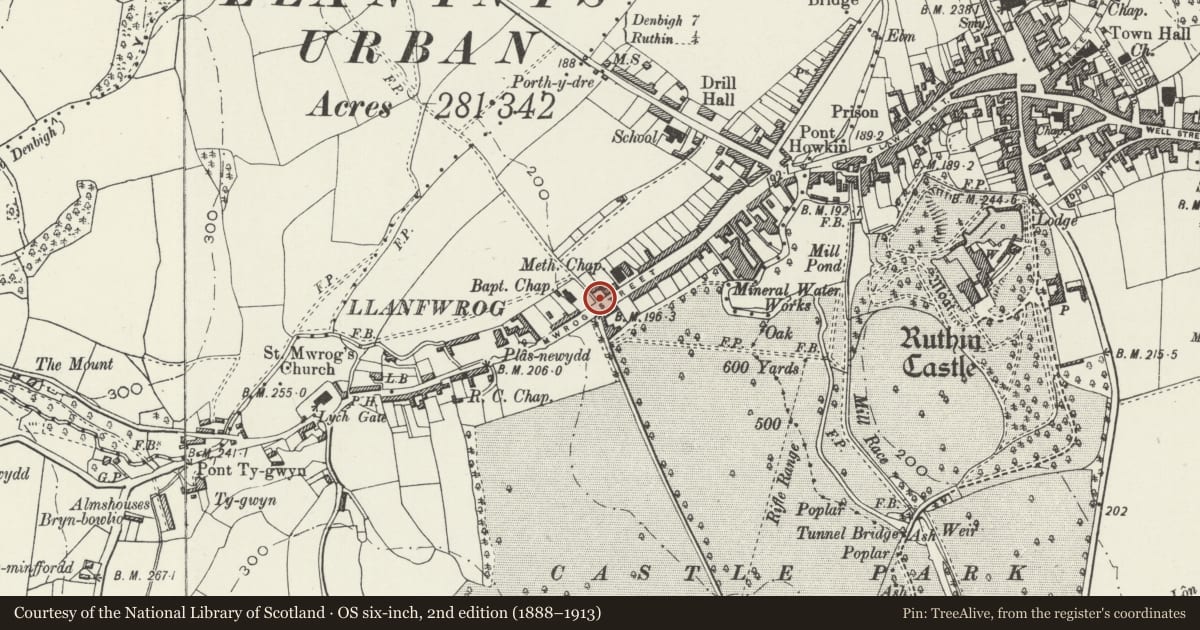
Slide toward Today to fade the historical sheet and see the modern map underneath.
David Rumsey Map Collection, Stanford LibrariesDavid Rumsey Map Collection, Stanford LibrariesLlyfrgell Genedlaethol Cymru – The National Library of WalesDavid Rumsey Map Collection, Stanford LibrariesDavid Rumsey Map Collection, Stanford Libraries
5 historical maps cover this location, the earliest the 1795 map "To Sir Watkin Williams-Wynn Bart ... the map of the six counties of North Wales is most humbly inscribed by his obedient humble servant" (Llyfrgell Genedlaethol Cymru – The National Library of Wales).
Historical maps covering this location
- 1795 · To Sir Watkin Williams-Wynn Bart ... the map of the six counties of North Wales is most… (Llyfrgell Genedlaethol Cymru – The National Library of Wales)
- 1830 · V.3:11-15:XV. Britisches Reich. A. Kon: England. b. Frstenthum Wales: Shire: 37-40 (David Rumsey Map Collection, Stanford Libraries)
- 1883 · Watershed map England, Wales 3. (David Rumsey Map Collection, Stanford Libraries)
- 1898 · 108 Flint (Hills) (David Rumsey Map Collection, Stanford Libraries)
- 1901 · Sheet 9 and 10. (David Rumsey Map Collection, Stanford Libraries)
Cadw's description
Location
Fronting the road almost opposite the junction of the A494 and the B5105 to Llanfwrog.
History
Picturesque garden wall, perhaps contemporary with house (c1835), but probably later. A door of 6 vertical panels with gothic metal fittings has been replaced since last resurvey.
Exterior
Constructed of large blocks of snecked limestone on a dressed stone plinth. Flat stone coping with concrete render over, supporting large free-standing water-worn limestone blocks, of different shapes set at various angles in good rustic fashion. Plain wooden door to centre, the coping rising over it, but also supporting limestone blocks. The wall has rounded front corners, that to L joining a rubble stone wall to footpath, that to R joining a shop.
Reason for designation
Listed as a C19 garden wall with good rustic picturesque character, and for group value with Glandwr.
Nearby in the register
- GlyndwrDomesticunder 1 mi
- 83 Mwrog StreetDomesticunder 1 mi
- 135 Mwrog StreetDomesticunder 1 mi
- 8 Mwrog SteetNo class recordedunder 1 mi
Other entries of the same register within about three miles of this one, by straight line.