Cof Cymru: National Historic Assets of Wales · Wales
135 Mwrog Street
Ruthin, Denbighshire, Wales
A Grade II listed building in Mwrog Street, Ruthin, Denbighshire, designated on 16 May 1978.
The record
- Designation
- Listed building, Grade II
- Broad class
- Domestic
- Date of designation
- 16 May 1978
- Locality
- Mwrog Street
- Town
- Ruthin
- Community
- Ruthin
- Unitary authority
- Denbighshire
- Country
- Wales
- Coordinates
- 53.11037, -3.32328
- Cadw reference
- 880
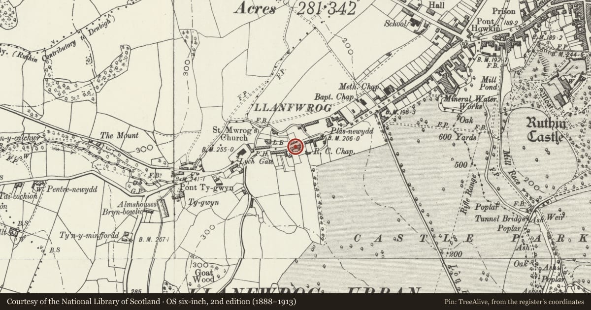
Slide toward Today to fade the historical sheet and see the modern map underneath.
David Rumsey Map Collection, Stanford LibrariesDavid Rumsey Map Collection, Stanford LibrariesLlyfrgell Genedlaethol Cymru – The National Library of WalesDavid Rumsey Map Collection, Stanford LibrariesDavid Rumsey Map Collection, Stanford Libraries
5 historical maps cover this location, the earliest the 1795 map "To Sir Watkin Williams-Wynn Bart ... the map of the six counties of North Wales is most humbly inscribed by his obedient humble servant" (Llyfrgell Genedlaethol Cymru – The National Library of Wales).
Historical maps covering this location
- 1795 · To Sir Watkin Williams-Wynn Bart ... the map of the six counties of North Wales is most… (Llyfrgell Genedlaethol Cymru – The National Library of Wales)
- 1830 · V.3:11-15:XV. Britisches Reich. A. Kon: England. b. Frstenthum Wales: Shire: 37-40 (David Rumsey Map Collection, Stanford Libraries)
- 1883 · Watershed map England, Wales 3. (David Rumsey Map Collection, Stanford Libraries)
- 1898 · 108 Flint (Hills) (David Rumsey Map Collection, Stanford Libraries)
- 1901 · Sheet 9 and 10. (David Rumsey Map Collection, Stanford Libraries)
Cadw's description
Location
Located at the W end of the street, approx 150m from the Church of St Mwrog.
History
Late C18-early C19, but perhaps with earlier origins.
Exterior
135, 137 and 137B form a group.
Two-storey terrace. Constructed of coursed blocks of squared stone under slate roofs with brick stacks. The openings are under segmental heads of stone voussoirs, except for the R-hand bay of 137 and 137B which have cambered stone heads. The windows are 2- or 3-light wooden casements. Rear said to be of painted rubble.
No 135 has ridge stack to R. C20 part-glazed wooden door to L and 3-light wooden window with central opening casement to R. Similar window aligned above. To L is a vehicular through-passage with elliptical head of stone voussoirs, with brick side wall to R. Above through-passage is a small uPVC window.
Interior
Interior not seen (8/12/05), but formerly had irregular exposed timbers of C18 or earlier.
Reason for designation
Listed for the late-Georgian character and detail of this row of cottages. Group value with 139-149 Mwrog Street.
Nearby in the register
- NannauDomesticunder 1 mi
- 137B Mwrog StreetDomesticunder 1 mi
- 139-145Domesticunder 1 mi
- 147 Mwrog StreetNo class recordedunder 1 mi
Other entries of the same register within about three miles of this one, by straight line.