Cof Cymru: National Historic Assets of Wales · Wales
Horse Trough at Coldwell Wood
Stackpole and Castlemartin, Pembrokeshire, Wales
A Grade II listed building in Stackpole, Stackpole and Castlemartin, Pembrokeshire, designated on 18 September 2023.
The record
- Designation
- Listed building, Grade II
- Broad class
- Water Supply and Drainage
- Date of designation
- 18 September 2023
- Welsh name
- Cafn dwr ceffylau yng Nghoed Coldwell
- Locality
- Stackpole
- Community
- Stackpole and Castlemartin
- Unitary authority
- Pembrokeshire
- Country
- Wales
- Coordinates
- 51.63176, -4.93456
- Cadw reference
- 87925
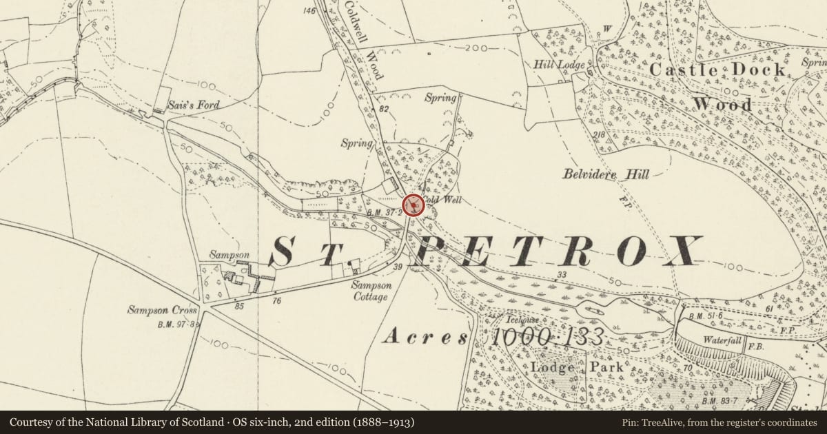
Slide toward Today to fade the historical sheet and see the modern map underneath.
David Rumsey Map Collection, Stanford LibrariesDavid Rumsey Map Collection, Stanford LibrariesDavid Rumsey Map Collection, Stanford LibrariesDavid Rumsey Map Collection, Stanford LibrariesDavid Rumsey Map Collection, Stanford Libraries
5 historical maps cover this location, the earliest the 1636 map "Cornubia : Devonia, Somersetus, Dorcestria, Wiltonia, Glocestria ..." (David Rumsey Map Collection, Stanford Libraries).
Historical maps covering this location
- 1636 · Cornubia : Devonia, Somersetus, Dorcestria, Wiltonia, Glocestria ... (David Rumsey Map Collection, Stanford Libraries)
- 1637 · The fourth table of England. Cornub. Devonia, Somerset etc. (David Rumsey Map Collection, Stanford Libraries)
- 1865 · England and Wales. England No. 6. (David Rumsey Map Collection, Stanford Libraries)
- 1891 · Sheet 10. Ordnance Survey of England and Wales. . (David Rumsey Map Collection, Stanford Libraries)
- 1898 · 245 Pembroke (Hills) (David Rumsey Map Collection, Stanford Libraries)
Cadw's description
Location
At the NW side of the junction of the B4319 with the unregistered road to Stackpole.
History
Historically within the Stackpole Estate. Not shown on the 1840 Tithe Map, nor as such on the first or second edition OS Maps, though the point is benchmarked on the latter two.
Exterior
Horse trough carved from a single block of local limestone, measuring approximately 5’ x 2’ x 1’ with curved corners and lip, on a plinth of limestone blocks. Built directly against the 1800 estate wall, at ground level. Stone spout channels the Coldwell Spring through the wall into the trough, over spilling the lip into a drain set in the plinth.
Reason for designation
Listed for its special architectural and historic interest as a rare C19 horse trough, a good example of its type, in its original location. The wall and spout are excluded from this listing.
Nearby in the register
- Ice HouseDomesticunder 1 mi
- Sampson FarmhouseDomesticunder 1 mi
- Garden CottageDomesticunder 1 mi
- One-Arch BridgeTransportunder 1 mi
Other entries of the same register within about three miles of this one, by straight line.