Cof Cymru: National Historic Assets of Wales · Wales
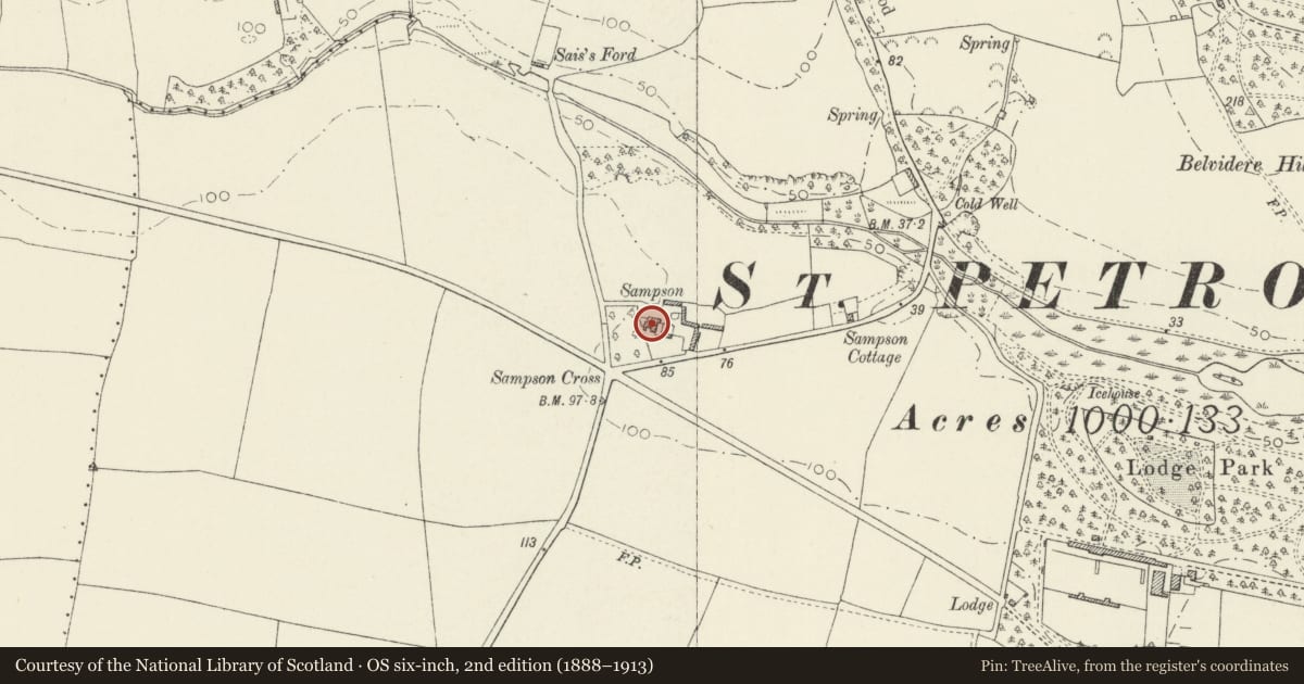
Sampson Farmhouse
Stackpole and Castlemartin, Pembrokeshire, Wales
A Grade II listed building in St. Petrox, Stackpole and Castlemartin, Pembrokeshire, designated on 14 May 1970.
The record
- Designation
- Listed building, Grade II
- Broad class
- Domestic
- Date of designation
- 14 May 1970
- Locality
- St. Petrox
- Community
- Stackpole and Castlemartin
- Unitary authority
- Pembrokeshire
- Country
- Wales
- Coordinates
- 51.63040, -4.94028
- Cadw reference
- 6017
Slide toward Today to fade the historical sheet and see the modern map underneath.
David Rumsey Map Collection, Stanford LibrariesDavid Rumsey Map Collection, Stanford LibrariesDavid Rumsey Map Collection, Stanford LibrariesDavid Rumsey Map Collection, Stanford LibrariesDavid Rumsey Map Collection, Stanford Libraries
5 historical maps cover this location, the earliest the 1636 map "Cornubia : Devonia, Somersetus, Dorcestria, Wiltonia, Glocestria ..." (David Rumsey Map Collection, Stanford Libraries).
Historical maps covering this location
- 1636 · Cornubia : Devonia, Somersetus, Dorcestria, Wiltonia, Glocestria ... (David Rumsey Map Collection, Stanford Libraries)
- 1637 · The fourth table of England. Cornub. Devonia, Somerset etc. (David Rumsey Map Collection, Stanford Libraries)
- 1865 · England and Wales. England No. 6. (David Rumsey Map Collection, Stanford Libraries)
- 1891 · Sheet 10. Ordnance Survey of England and Wales. . (David Rumsey Map Collection, Stanford Libraries)
- 1898 · 245 Pembroke (Hills) (David Rumsey Map Collection, Stanford Libraries)
Cadw's description
Exterior
At N opposite to the junction where the Bosherston road leaves the B4319.
C18 farmhouse facing E, two storeys, three window range with central door and modern porch. Cl9 sash windows. Rendered rubble masonry, slate roof. End chimneys. Lean-to former dairy al N.
Internal doors panelled. Centrally at the rear of the house is a large single unit wing also in rendered rubble masonry with slate roof at the same height as the front range. At its W a very large end-chimney with a deep timber bressummer. Corbelled stonework, much blackened. Two ovens of different sizes. Large lean-to extension with corn drying or malting.
Cellar lined in rough-hewn masonry beneath the S room with stairs at rear.
Listed for very fine chimney with bread ovens and corn dryer.
Reference: Dyfed Arch. Trust S&~ PRN 6981
Nearby in the register
- Sampson Cross Standing StoneStanding Stoneunder 1 mi
- Horse Trough at Coldwell WoodWater Supply and Drainageunder 1 mi
- Ice HouseDomesticunder 1 mi
- Stackpole Farm Standing StoneStanding Stoneunder 1 mi
Other entries of the same register within about three miles of this one, by straight line.