Cof Cymru: National Historic Assets of Wales · Wales
Milestone near Bryn Hyfryd
Llanddowror, Carmarthenshire, Wales
A Grade II listed building in Cyffig, Llanddowror, Carmarthenshire, designated on 11 March 2021.
The record
- Designation
- Listed building, Grade II
- Broad class
- No class recorded
- Date of designation
- 11 March 2021
- Welsh name
- Carreg filltir ger Bryn Hyfryd
- Locality
- Cyffig
- Community
- Llanddowror
- Unitary authority
- Carmarthenshire
- Country
- Wales
- Coordinates
- 51.79408, -4.57036
- Cadw reference
- 87835
Slide toward Today to fade the historical sheet and see the modern map underneath.
David Rumsey Map Collection, Stanford LibrariesDavid Rumsey Map Collection, Stanford LibrariesDavid Rumsey Map Collection, Stanford LibrariesDavid Rumsey Map Collection, Stanford LibrariesDavid Rumsey Map Collection, Stanford Libraries
5 historical maps cover this location, the earliest the 1636 map "Cornubia : Devonia, Somersetus, Dorcestria, Wiltonia, Glocestria ..." (David Rumsey Map Collection, Stanford Libraries).
Historical maps covering this location
- 1636 · Cornubia : Devonia, Somersetus, Dorcestria, Wiltonia, Glocestria ... (David Rumsey Map Collection, Stanford Libraries)
- 1830 · V.3:11-15:XV. Britisches Reich. A. Kon: England. b. Frstenthum Wales: Shire: 37-40 (David Rumsey Map Collection, Stanford Libraries)
- 1891 · Sheet 10. Ordnance Survey of England and Wales. . (David Rumsey Map Collection, Stanford Libraries)
- 1898 · 229 Carmarthen (Hills) (David Rumsey Map Collection, Stanford Libraries)
- 1901 · Sheet 14. (David Rumsey Map Collection, Stanford Libraries)
Cadw's description
Location
In a modern cutting on the S side of lately re-routed minor road between Llanddowror and Tavernspite, approximately 50m SW of Bryn Hyfryd farm and 2.8km WSW of Llandowror village.
History
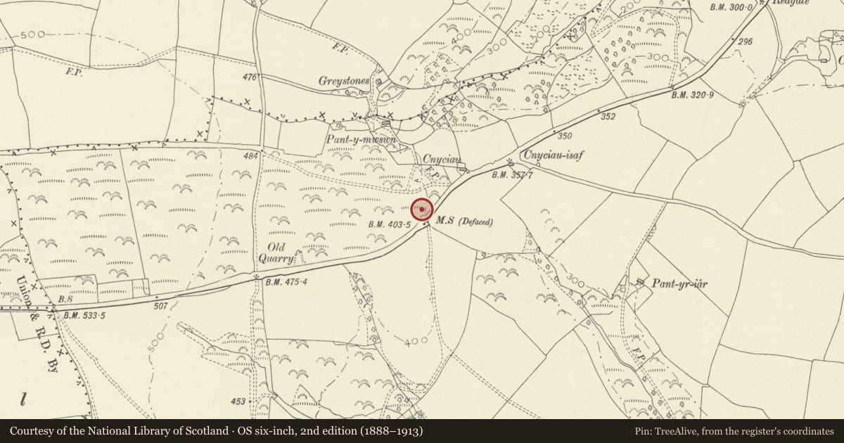
The milestone was on the main London to Milford Haven coach roads that passed through Carmarthen and Tavernspite, which was turnpiked in 1772 by the Carmarthenshire Main Trust. The milestone was moved 46.2m to its present position in 2014 when the line of the road was straightened to make way for the new A477. The stone is marked in its original position on the 1888 OS map.
Exterior
Tall monolith with incised and black-painted letters and numerals on the front. It reads ‘24 Mile ILandilo XII Carmarthen’.
Reason for designation
Listed, notwithstanding having been relocated during road modernisation works, as a well-lettered C18 milestone on a historically important route between London and Milford Haven.
Nearby in the register
- Boundary stone near Gelli-Felen (partly in Eglwyscummin Community)No class recordedunder 1 mi
- Milestone on A477 at ParciauTransportunder 1 mi
- BrunantDomesticunder 1 mi
- Milestone NE of Rhos-gochTransportunder 1 mi
Other entries of the same register within about three miles of this one, by straight line.