Cof Cymru: National Historic Assets of Wales · Wales
Boundary stone near Gelli-Felen (partly in Eglwyscummin Community)
Llanddowror, Carmarthenshire, Wales
A Grade II listed building in Cyffig, Llanddowror, Carmarthenshire, designated on 11 March 2021.
The record
- Designation
- Listed building, Grade II
- Broad class
- No class recorded
- Date of designation
- 11 March 2021
- Welsh name
- Carreg derfyn ger Gellifelen (yn rhannol yng Nghymuned Eglwys Gymyn)
- Locality
- Cyffig
- Community
- Llanddowror
- Unitary authority
- Carmarthenshire
- Country
- Wales
- Coordinates
- 51.79230, -4.58155
- Cadw reference
- 87834
Slide toward Today to fade the historical sheet and see the modern map underneath.
David Rumsey Map Collection, Stanford LibrariesDavid Rumsey Map Collection, Stanford LibrariesDavid Rumsey Map Collection, Stanford LibrariesDavid Rumsey Map Collection, Stanford LibrariesDavid Rumsey Map Collection, Stanford Libraries
5 historical maps cover this location, the earliest the 1608 map "(13) Cambriae Typus." (David Rumsey Map Collection, Stanford Libraries).
Historical maps covering this location
- 1608 · (13) Cambriae Typus. (David Rumsey Map Collection, Stanford Libraries)
- 1636 · Cornubia : Devonia, Somersetus, Dorcestria, Wiltonia, Glocestria ... (David Rumsey Map Collection, Stanford Libraries)
- 1830 · V.3:11-15:XV. Britisches Reich. A. Kon: England. b. Frstenthum Wales: Shire: 37-40 (David Rumsey Map Collection, Stanford Libraries)
- 1891 · Sheet 10. Ordnance Survey of England and Wales. . (David Rumsey Map Collection, Stanford Libraries)
- 1898 · 229 Carmarthen (Hills) (David Rumsey Map Collection, Stanford Libraries)
Cadw's description
Location
Between 2 field gates on the N side of a minor road between Llanddowror and Tavernspite, approximately 3.6km WSW of Llanddowror village.
History
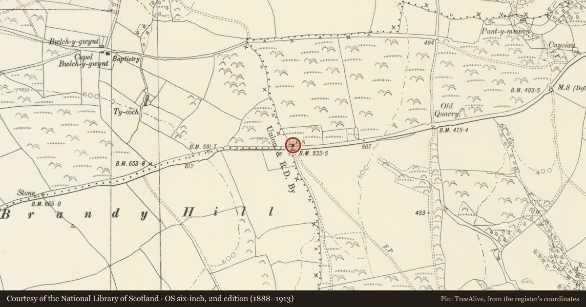
C19 stone on the boundary between Llandowror and Eglwys Cymun parishes, marked on the 1888 OS map.
Exterior
Boundary stone in the form of a dressed limestone slab with splayed front. Each of the 2 facets has a a rounded top. On each face is an incised hand with finger pointing L and R respectively, and engraved ‘Eglwys Cymmyn Parish’ on the L and ‘Landowror [sic] Parish’ on the R.
Reason for designation
Listed as a well-lettered boundary stone, one of several similar boundary stones in west Carmarthenshire and eastern Pembrokeshire, and as one of a pair of stones marking the boundary of Llanddowror Parish.
Nearby in the register
- BrunantDomesticunder 1 mi
- Milestone near Bryn HyfrydNo class recordedunder 1 mi
- Milestone NE of Rhos-gochTransportunder 1 mi
- Cyffig ChurchReligious, Ritual and Funeraryunder 1 mi
Other entries of the same register within about three miles of this one, by straight line.