Cof Cymru: National Historic Assets of Wales · Wales
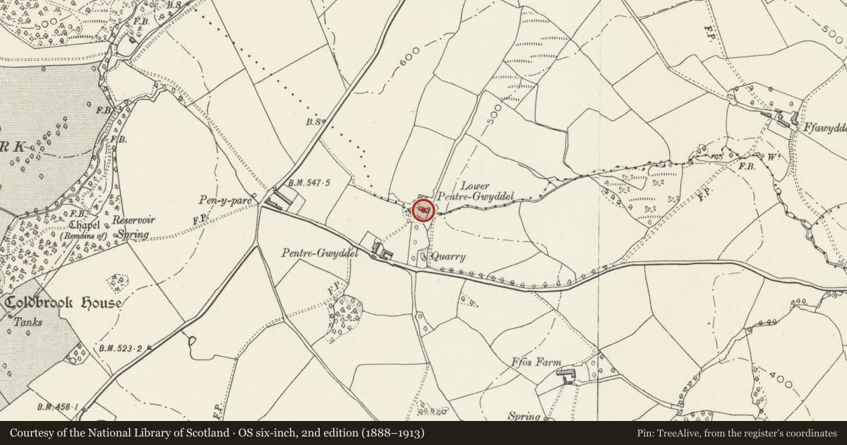
Lower Pentre Gwyddel
Gobion Fawr, Monmouthshire, Wales
A Grade II listed building in Coldbrook, Gobion Fawr, Monmouthshire, designated on 3 July 2007.
The record
- Designation
- Listed building, Grade II
- Broad class
- Domestic
- Date of designation
- 3 July 2007
- Locality
- Coldbrook
- Community
- Gobion Fawr
- Unitary authority
- Monmouthshire
- Country
- Wales
- Coordinates
- 51.80924, -2.98310
- Cadw reference
- 87532
Slide toward Today to fade the historical sheet and see the modern map underneath.
David Rumsey Map Collection, Stanford LibrariesDavid Rumsey Map Collection, Stanford LibrariesDavid Rumsey Map Collection, Stanford LibrariesDavid Rumsey Map Collection, Stanford LibrariesDavid Rumsey Map Collection, Stanford Libraries
5 historical maps cover this location, the earliest the 1636 map "Cornubia : Devonia, Somersetus, Dorcestria, Wiltonia, Glocestria ..." (David Rumsey Map Collection, Stanford Libraries).
Historical maps covering this location
- 1636 · Cornubia : Devonia, Somersetus, Dorcestria, Wiltonia, Glocestria ... (David Rumsey Map Collection, Stanford Libraries)
- 1895 · Sheet 11. Ordnance Survey of England and Wales. (David Rumsey Map Collection, Stanford Libraries)
- 1898 · 232 Abergavenny (Hills) (David Rumsey Map Collection, Stanford Libraries)
- 1898 · 232 Abergavenny (Outline) (David Rumsey Map Collection, Stanford Libraries)
- 1901 · Sheet 14. (David Rumsey Map Collection, Stanford Libraries)
Cadw's description
Location
To N of minor road, about 1km E of Coldbrook Park.
History
Probable origins as a C17 house, with later agricultural range to east; C20 lean-to extension to west end.
Exterior
Small farmhouse; painted rubble with slate roof; end chimneys in brick. Entrance faces S, and has central doorway under open gabled porch; to each side, a 2-light window with casement glazing, above each of which is a small catslide dormer set across eaves. To R, a lower in-line block with doorway, and dormer with catslide roof. At L end, a projecting chimney breast with tall brick stack; modern lean-to extension. Ground falls away to rear where main block has, facing yard, 2 very small windows at eaves, set towards L, vertical ground floor window near centre, and a 2-light casement to its R. The lower block has pair of doorways to centre, with small window to R, and a very small window at eaves; lean-to block at right angles has corrugated roof covering.
Interior
Not available.
Reason for designation
Included as farmhouse with good character and probable C17 origins.
Nearby in the register
- Barn at Pentre-Gwyddel FarmAgriculture and Subsistenceunder 1 mi
- Pentre-GwyddelDomesticunder 1 mi
- Coldbrook ChapelReligious, Ritual and Funeraryunder 1 mi
- Upper Pant FarmhouseDomesticunder 1 mi
Other entries of the same register within about three miles of this one, by straight line.