Cof Cymru: National Historic Assets of Wales · Wales
Barn at Pentre-Gwyddel Farm
Gobion Fawr, Monmouthshire, Wales
A Grade II listed building in Coldbrook Park, Abergavenny, Gobion Fawr, Monmouthshire, designated on 9 December 2005.
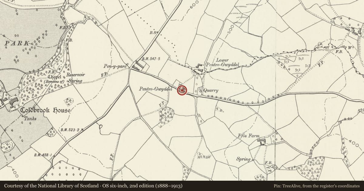
The record
- Designation
- Listed building, Grade II
- Broad class
- Agriculture and Subsistence
- Date of designation
- 9 December 2005
- Locality
- Coldbrook Park
- Town
- Abergavenny
- Community
- Gobion Fawr
- Unitary authority
- Monmouthshire
- Country
- Wales
- Coordinates
- 51.80837, -2.98440
- Cadw reference
- 87137
Slide toward Today to fade the historical sheet and see the modern map underneath.
David Rumsey Map Collection, Stanford LibrariesDavid Rumsey Map Collection, Stanford LibrariesDavid Rumsey Map Collection, Stanford LibrariesDavid Rumsey Map Collection, Stanford LibrariesDavid Rumsey Map Collection, Stanford Libraries
5 historical maps cover this location, the earliest the 1636 map "Cornubia : Devonia, Somersetus, Dorcestria, Wiltonia, Glocestria ..." (David Rumsey Map Collection, Stanford Libraries).
Historical maps covering this location
- 1636 · Cornubia : Devonia, Somersetus, Dorcestria, Wiltonia, Glocestria ... (David Rumsey Map Collection, Stanford Libraries)
- 1895 · Sheet 11. Ordnance Survey of England and Wales. (David Rumsey Map Collection, Stanford Libraries)
- 1898 · 232 Abergavenny (Hills) (David Rumsey Map Collection, Stanford Libraries)
- 1898 · 232 Abergavenny (Outline) (David Rumsey Map Collection, Stanford Libraries)
- 1901 · Sheet 14. (David Rumsey Map Collection, Stanford Libraries)
Cadw's description
Location
Opposite the farmhouse on the east side of the yard.
History
Probably C18 and apparently little altered apart from the south gable end.
Exterior
Built of whitened local red sandstone rubble with a natural slate roof. Large rectangular threshing barn with cowhouse and hayloft at south end.
Yard elevation: Central through doors with two tiered slit vents on the north end and the upper ones on the south end. Door to ground floor right, also a small lean-to between this and the main door. Plain roof with projecting eaves, probably late C19.
Left gable is rendered, right gable has the upper part of the wall rebuilt in red brick.
Rear elevation also has slit vents but most of the walling is hidden by later additions and lean-tos.
Interior
Interior not available at resurvey, but this is probably a 7-bay barn.
Reason for designation
Included for its special interest as a well preserved probably C18 barn of regional type, which has strong group value with the adjoning farmhouse.
Nearby in the register
- Pentre-GwyddelDomesticunder 1 mi
- Lower Pentre GwyddelDomesticunder 1 mi
- Coldbrook ChapelReligious, Ritual and Funeraryunder 1 mi
- Upper Pant FarmhouseDomesticunder 1 mi
Other entries of the same register within about three miles of this one, by straight line.