Cof Cymru: National Historic Assets of Wales · Wales
Huntsman's Cottage
Llanarth, Monmouthshire, Wales
A Grade II listed building in Pit, Raglan, Llanarth, Monmouthshire, designated on 3 July 2007.
The record
- Designation
- Listed building, Grade II
- Broad class
- Domestic
- Date of designation
- 3 July 2007
- Locality
- Pit
- Town
- Raglan
- Community
- Llanarth
- Unitary authority
- Monmouthshire
- Country
- Wales
- Coordinates
- 51.77913, -2.91005
- Cadw reference
- 87495
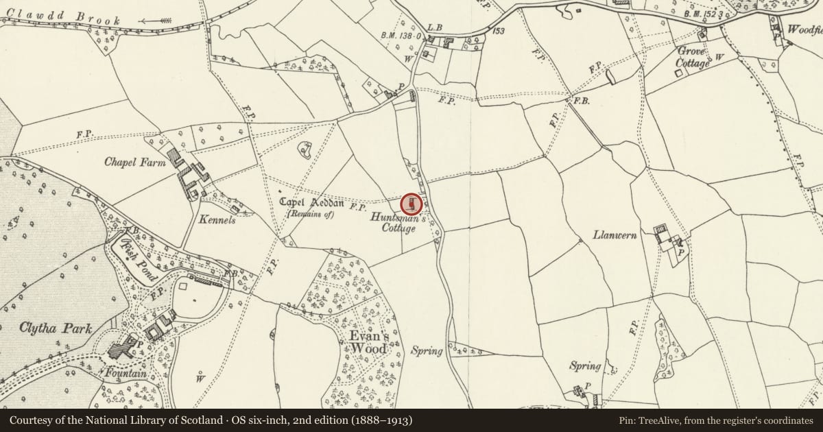
Slide toward Today to fade the historical sheet and see the modern map underneath.
David Rumsey Map Collection, Stanford LibrariesDavid Rumsey Map Collection, Stanford LibrariesDavid Rumsey Map Collection, Stanford LibrariesDavid Rumsey Map Collection, Stanford LibrariesDavid Rumsey Map Collection, Stanford Libraries
5 historical maps cover this location, the earliest the 1608 map "(13) Cambriae Typus." (David Rumsey Map Collection, Stanford Libraries).
Historical maps covering this location
- 1608 · (13) Cambriae Typus. (David Rumsey Map Collection, Stanford Libraries)
- 1636 · Cornubia : Devonia, Somersetus, Dorcestria, Wiltonia, Glocestria ... (David Rumsey Map Collection, Stanford Libraries)
- 1830 · V.3:11-15:XV.Britisches Reich. A. Kon: England. a. England ab sich: Shire:15-17, 33 (David Rumsey Map Collection, Stanford Libraries)
- 1895 · Sheet 11. Ordnance Survey of England and Wales. (David Rumsey Map Collection, Stanford Libraries)
- 1913 · Sheet 102. Newport. (David Rumsey Map Collection, Stanford Libraries)
Cadw's description
Location
South of main hamlet of Pit, to W of minor road immediately to N of A 40.
History
Probably mid-to-late C19.
Exterior
One-and-a-half storey cottage. Stone, with natural slate roof and rectangular end chimneys in brick; openings generally with shallow pointed-arched heads; casement glazing. Entrance front faces away from road. Two gables each with a 2-light casement window. On ground floor, central doorway with shallow-arched head, and trellis porch; to L, a 3-light casement window, to R, a 2-light casement window. To L of main block, a single-storey block. To R of main block, a single-storey modern extension.
Reason for designation
Well-preserved mid-to-late C19 estate cottage.
Nearby in the register
- Pit CottagesDomesticunder 1 mi
- Chapel Farmhouse and attached outbuildingDomesticunder 1 mi
- Pit Farm CottageDomesticunder 1 mi
- Walled garden at Clytha ParkGardens, Parks and Urban Spacesunder 1 mi
Other entries of the same register within about three miles of this one, by straight line.