Cof Cymru: National Historic Assets of Wales · Wales
Pit Farm Cottage
Llanarth, Monmouthshire, Wales
A Grade II listed building in The Pitt, Llanarth, Monmouthshire, designated on 9 January 1956.
The record
- Designation
- Listed building, Grade II
- Broad class
- Domestic
- Date of designation
- 9 January 1956
- Locality
- The Pitt
- Community
- Llanarth
- Unitary authority
- Monmouthshire
- Country
- Wales
- Coordinates
- 51.78328, -2.91113
- Cadw reference
- 1973
Slide toward Today to fade the historical sheet and see the modern map underneath.
David Rumsey Map Collection, Stanford LibrariesDavid Rumsey Map Collection, Stanford LibrariesDavid Rumsey Map Collection, Stanford LibrariesDavid Rumsey Map Collection, Stanford LibrariesDavid Rumsey Map Collection, Stanford Libraries
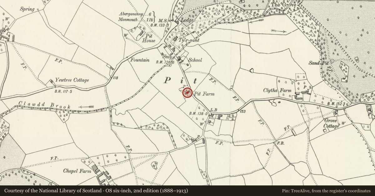
5 historical maps cover this location, the earliest the 1636 map "Cornubia : Devonia, Somersetus, Dorcestria, Wiltonia, Glocestria ..." (David Rumsey Map Collection, Stanford Libraries).
Historical maps covering this location
- 1636 · Cornubia : Devonia, Somersetus, Dorcestria, Wiltonia, Glocestria ... (David Rumsey Map Collection, Stanford Libraries)
- 1830 · V.3:11-15:XV.Britisches Reich. A. Kon: England. a. England ab sich: Shire:15-17, 33 (David Rumsey Map Collection, Stanford Libraries)
- 1895 · Sheet 11. Ordnance Survey of England and Wales. (David Rumsey Map Collection, Stanford Libraries)
- 1901 · Sheet 14. (David Rumsey Map Collection, Stanford Libraries)
- 1913 · Sheet 102. Newport. (David Rumsey Map Collection, Stanford Libraries)
Cadw's description
Location
Situated on W side of road running S from The Pitt village.
History
Small house, with datestone of 1737 referring to the original building date. Presumably originally a small farm or small-holding, and marked on the 1845 Tithe map as owned by Williams Jones of Clytha, occupied by James Price, with 20 acres (8.1 hectares). The house was extensively remodelled by the Llanarth estate, probably in the early C20.
Exterior
Small house; 2 storeyed, 2-unit plan. Roughcast render and slate roof with small brick end-wall stacks. South elevation has near-central door beneath modern lean-to porch, flanked by renewed 3-light small-paned casement windows on each floor; datestone of 1737 with initials I and C.M. (probably re-sited). North elevation has the more distinctive simple arts and crafts detail associated with the Llanarth estate, and has central doorway flanked by 2-light casement windows, with 3 similar windows above.
Reason for designation
Listed as a small farmhouse of C18 origins, remodelled later in the arts and crafts style of the Llanarth estate, and retaining character as a small estate house.
Nearby in the register
- Pit CottagesDomesticunder 1 mi
- Ty'r NantDomesticunder 1 mi
- Gatehouse at Llanarth CourtDomesticunder 1 mi
- Pit HouseDomesticunder 1 mi
Other entries of the same register within about three miles of this one, by straight line.