Cof Cymru: National Historic Assets of Wales · Wales
Iron Bridge in grounds of Woodfield Park
Penmaen, Caerphilly, Wales
A Grade II listed building in Penmaen, Caerphilly, designated on 7 June 2006.
The record
- Designation
- Listed building, Grade II
- Broad class
- Gardens, Parks and Urban Spaces
- Date of designation
- 7 June 2006
- Community
- Penmaen
- Unitary authority
- Caerphilly
- Country
- Wales
- Coordinates
- 51.66787, -3.18817
- Cadw reference
- 87492
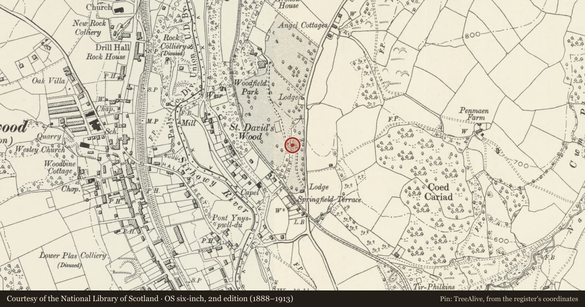
Slide toward Today to fade the historical sheet and see the modern map underneath.
David Rumsey Map Collection, Stanford LibrariesDavid Rumsey Map Collection, Stanford LibrariesDavid Rumsey Map Collection, Stanford LibrariesDavid Rumsey Map Collection, Stanford LibrariesDavid Rumsey Map Collection, Stanford Libraries
5 historical maps cover this location, the earliest the 1636 map "Cornubia : Devonia, Somersetus, Dorcestria, Wiltonia, Glocestria ..." (David Rumsey Map Collection, Stanford Libraries).
Historical maps covering this location
- 1636 · Cornubia : Devonia, Somersetus, Dorcestria, Wiltonia, Glocestria ... (David Rumsey Map Collection, Stanford Libraries)
- 1637 · The fourth table of England. Cornub. Devonia, Somerset etc. (David Rumsey Map Collection, Stanford Libraries)
- 1895 · Sheet 11. Ordnance Survey of England and Wales. (David Rumsey Map Collection, Stanford Libraries)
- 1906 · 249 Newport (Hills) (David Rumsey Map Collection, Stanford Libraries)
- 1913 · Sheet 102. Newport. (David Rumsey Map Collection, Stanford Libraries)
Cadw's description
Location
In the grounds of Woodfield Park, about 300m SSE of the house over a steeply sided stream.
History
The bridge brought the drive of Woodfield from the former lower lodge over a steeply sided stream. It is dated 1829, and was made by the Cardiff Foundry. The owner then was John Hodder Moggridge, a coal owner.
Exterior
Iron bridge consisting of 5 parallel one-piece cast iron beams tied together with straps. The outer beams are embossed with a raised frieze with keystones bearing the date "1829", and are pierced with 4 openings; at one end of each outer beam "Cardiff", and at the other "Foundry". Dry stone abutments. The wrought iron handrails survive, although one is currently not in situ. Four posts support a handrail with scrolled ends. The bridge is about 3 metres wide, and about 5.5 metres long.
Reason for designation
An early C19 iron bridge retaining much of its character. This is a relatively early use of iron for a bridge.
Nearby in the register
- Blackwood Miners Welfare InstituteInstitutionalunder 1 mi
- Former Tramroad Bridge (partly in Penmaen Community)Transportunder 1 mi
- Former Tramroad Bridge (partly in Pontllanfraith Community)Transportunder 1 mi
- Blackwood War MemorialCommemorativeunder 1 mi
Other entries of the same register within about three miles of this one, by straight line.