Cof Cymru: National Historic Assets of Wales · Wales
42 Bridge Street
Aberystwyth, Ceredigion, Wales
A Grade II listed building in Aberystwyth, Ceredigion, designated on 10 May 2006.
The record
- Designation
- Listed building, Grade II
- Broad class
- Domestic
- Date of designation
- 10 May 2006
- Locality
- Aberystwyth
- Community
- Aberystwyth
- Unitary authority
- Ceredigion
- Country
- Wales
- Coordinates
- 52.41250, -4.08523
- Cadw reference
- 87490
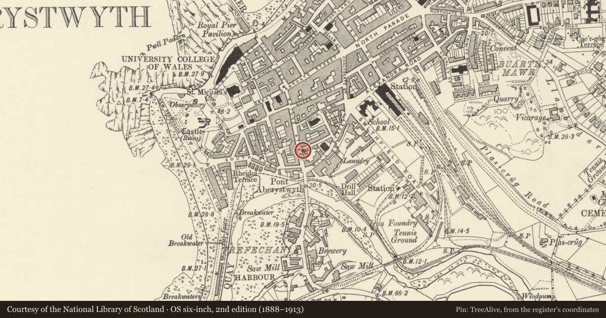
Slide toward Today to fade the historical sheet and see the modern map underneath.
David Rumsey Map Collection, Stanford LibrariesDavid Rumsey Map Collection, Stanford LibrariesDavid Rumsey Map Collection, Stanford LibrariesDavid Rumsey Map Collection, Stanford LibrariesDavid Rumsey Map Collection, Stanford Libraries
5 historical maps cover this location, the earliest the 1830 map "V.3:11-15:XV. Britisches Reich. A. Kon: England. b. Frstenthum Wales: Shire: 37-40" (David Rumsey Map Collection, Stanford Libraries).
Historical maps covering this location
- 1830 · V.3:11-15:XV. Britisches Reich. A. Kon: England. b. Frstenthum Wales: Shire: 37-40 (David Rumsey Map Collection, Stanford Libraries)
- 1883 · Watershed map England, Wales 3. (David Rumsey Map Collection, Stanford Libraries)
- 1896 · Sheet 7. Ordnance Survey of England and Wales. (David Rumsey Map Collection, Stanford Libraries)
- 1899 · 163 Aberystwyth (Hills) (David Rumsey Map Collection, Stanford Libraries)
- 1901 · Sheet 14. (David Rumsey Map Collection, Stanford Libraries)
Cadw's description
Location
On the corner with Powell Street.
History
Probably mid C19. Old maps show 2 small houses on this site before breaking through of Powell Street.
Exterior
Three storey, three window house. Rendered with quoins and moulded architraves, slate roof with end chimneys in polychrome brick.
Left hand bay has a top floor 4-pane sash above splayed oriel window, and on ground floor, a broad 6-pane former shop window with cornice.
Central bay has a top floor blind window above first floor 4-pane sash, and, on ground floor, a doorway with cornice and moulded door frame; rectangular overlight. Right hand bay has a top floor 4-pane sash above a two-storey splayed bay window. Left gable end to Powell Street has 2 small sash windows set towards rear.
Interior
Not inspected.
Reason for designation
Included for Group Value with adjacent listed No 44, and with Listed buildings opposite.
Nearby in the register
- 44 Bridge StreetDomesticunder 1 mi
- 49 Bridge StreetDomesticunder 1 mi
- GraigwenDomesticunder 1 mi
- 47 Bridge StreetDomesticunder 1 mi
Other entries of the same register within about three miles of this one, by straight line.