Cof Cymru: National Historic Assets of Wales · Wales
49 Bridge Street
Aberystwyth, Ceredigion, Wales
A Grade II listed building in Aberystwyth, Ceredigion, designated on 21 July 1961.
The record
- Designation
- Listed building, Grade II
- Broad class
- Domestic
- Date of designation
- 21 July 1961
- Community
- Aberystwyth
- Unitary authority
- Ceredigion
- Country
- Wales
- Coordinates
- 52.41248, -4.08554
- Cadw reference
- 10198
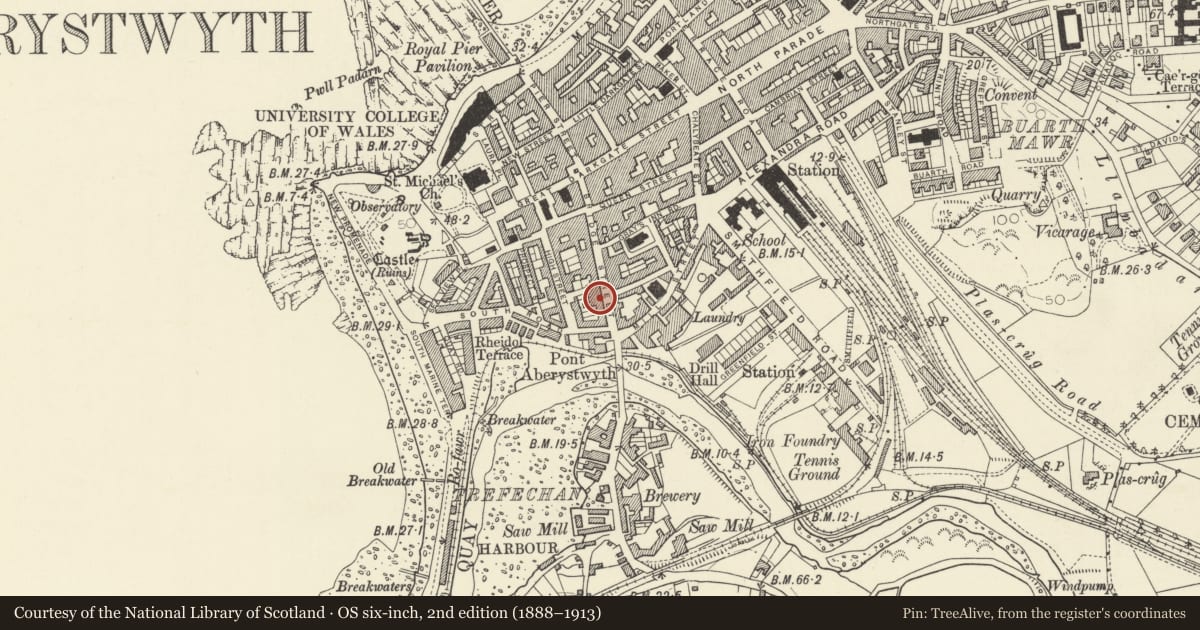
Slide toward Today to fade the historical sheet and see the modern map underneath.
David Rumsey Map Collection, Stanford LibrariesDavid Rumsey Map Collection, Stanford LibrariesDavid Rumsey Map Collection, Stanford LibrariesDavid Rumsey Map Collection, Stanford LibrariesDavid Rumsey Map Collection, Stanford Libraries
5 historical maps cover this location, the earliest the 1830 map "V.3:11-15:XV. Britisches Reich. A. Kon: England. b. Frstenthum Wales: Shire: 37-40" (David Rumsey Map Collection, Stanford Libraries).
Historical maps covering this location
- 1830 · V.3:11-15:XV. Britisches Reich. A. Kon: England. b. Frstenthum Wales: Shire: 37-40 (David Rumsey Map Collection, Stanford Libraries)
- 1883 · Watershed map England, Wales 3. (David Rumsey Map Collection, Stanford Libraries)
- 1896 · Sheet 7. Ordnance Survey of England and Wales. (David Rumsey Map Collection, Stanford Libraries)
- 1899 · 163 Aberystwyth (Hills) (David Rumsey Map Collection, Stanford Libraries)
- 1901 · Sheet 14. (David Rumsey Map Collection, Stanford Libraries)
Cadw's description
Location
Set into a continuous row of frontages near the bottom of the street, No 51 stepped down to left.
History
Buildings shown on site on ca.1790 map.
Exterior
Late Georgian with Victorian alterations. 3-storey and attic, 2-window scribed render fronts; more broadly spaced to No 45 and Nos 47 and 49 are reflected pairs with cill band. Slate roofs, bracket eaves and rubble chimney stack; slate hung dormers with pitched root to No 45 and cambered roofs to Nos 47 and 49. Mainly horned sash window without glazing bars; 3-storey splayed bay windows to each with bracket cornices and panelled aprons; architraves to right hand windows of No 45 and central windows of Nos 47 and 49, blind to 2nd floor. Doric paired doorcase to Nos 47 and 49 with dentil cornice, and panelled reveals; Victorian doorcase to No 45; half glazed and panelled doors.
Reason for designation
Group value.
Nearby in the register
- 47 Bridge StreetDomesticunder 1 mi
- GraigwenDomesticunder 1 mi
- 45 Bridge StreetDomesticunder 1 mi
- The Old Bank HouseEducationunder 1 mi
Other entries of the same register within about three miles of this one, by straight line.