Cof Cymru: National Historic Assets of Wales · Wales
Weighbridge Cottage
Talybont-on-Usk, Powys, Wales
A Grade II listed building in Talybont-on-Usk, Powys, designated on 30 January 2006.
The record
- Designation
- Listed building, Grade II
- Broad class
- Transport
- Date of designation
- 30 January 2006
- Locality
- Talybont-on-Usk
- Community
- Talybont-on-Usk
- Unitary authority
- Powys
- Country
- Wales
- Coordinates
- 51.89362, -3.28874
- Cadw reference
- 87471
Slide toward Today to fade the historical sheet and see the modern map underneath.
David Rumsey Map Collection, Stanford LibrariesDavid Rumsey Map Collection, Stanford LibrariesDavid Rumsey Map Collection, Stanford LibrariesDavid Rumsey Map Collection, Stanford LibrariesDavid Rumsey Map Collection, Stanford Libraries
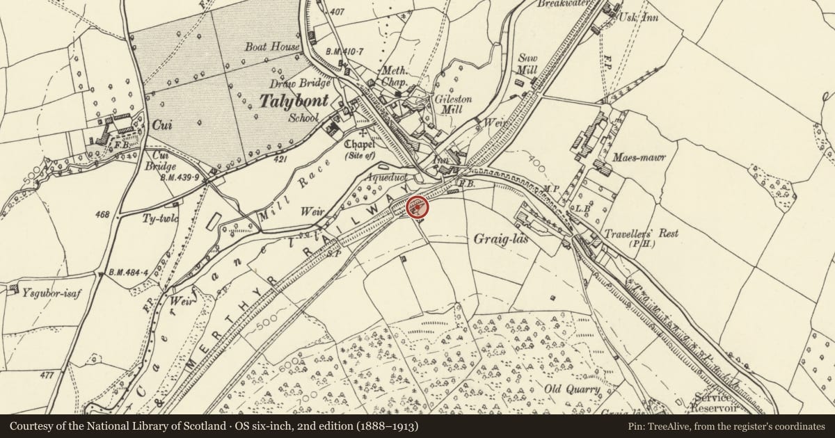
5 historical maps cover this location, the earliest the 1608 map "(13) Cambriae Typus." (David Rumsey Map Collection, Stanford Libraries).
Historical maps covering this location
- 1608 · (13) Cambriae Typus. (David Rumsey Map Collection, Stanford Libraries)
- 1636 · Cornubia : Devonia, Somersetus, Dorcestria, Wiltonia, Glocestria ... (David Rumsey Map Collection, Stanford Libraries)
- 1856 · 42. Brecon. (David Rumsey Map Collection, Stanford Libraries)
- 1896 · 214 Talgarth (Hills) (David Rumsey Map Collection, Stanford Libraries)
- 1901 · Sheet 14. (David Rumsey Map Collection, Stanford Libraries)
Cadw's description
Location
South of canal, on line of old tramway. Reached via lane to W of White Hart Inn.
History
Built either circa 1815, or as an additional weighbridge house circa 1820. Formerly a weighbridge house for the Brinore (or Brynoer) Tramroad built 1814-15. Plans for 2 toll-houses on the tramroad were approved on 13 June 1815, and in 1820, users requested the building of an additional weighbridge. The building shares stylistic features with the former 'Counting House' of the tramroad also at Tal-y-Bont (Grid Ref 311760 222350).
Exterior
Two-storey cottage facing line of former tramroad. Brown stone; modern corrugated roof to right hand section with small Gothic window at upper level; on ground floor, to L, camber-headed doorway with boarded door to L, and to R, a Gothic window. Small Gothic window in R return.
To L, roofless section with fireplace to rear and large rectangular chimney; doorway to L return.
Reason for designation
Building from the second decade of the C19 listed for its historic interest as one of the few upstanding buildings associated with the Brinore Tramroad.
Nearby in the register
- White Hart Bridge (Canal Bridge No.143) including attached retaining wallTransportunder 1 mi
- Talybont Aqueduct (Monmouthshire and Brecon Canal)Transportunder 1 mi
- White Hart InnCommercialunder 1 mi
- Pair of railway bridges over road and canal at TalybontTransportunder 1 mi
Other entries of the same register within about three miles of this one, by straight line.