Cof Cymru: National Historic Assets of Wales · Wales
Gazebo to rear of the Coach House
Ruthin, Denbighshire, Wales
A Grade II listed building in Castle Street, Ruthin, Denbighshire, designated on 30 December 2005.
The record
- Designation
- Listed building, Grade II
- Broad class
- No class recorded
- Date of designation
- 30 December 2005
- Locality
- Castle Street
- Town
- Ruthin
- Community
- Ruthin
- Unitary authority
- Denbighshire
- Country
- Wales
- Coordinates
- 53.11323, -3.31149
- Cadw reference
- 87331
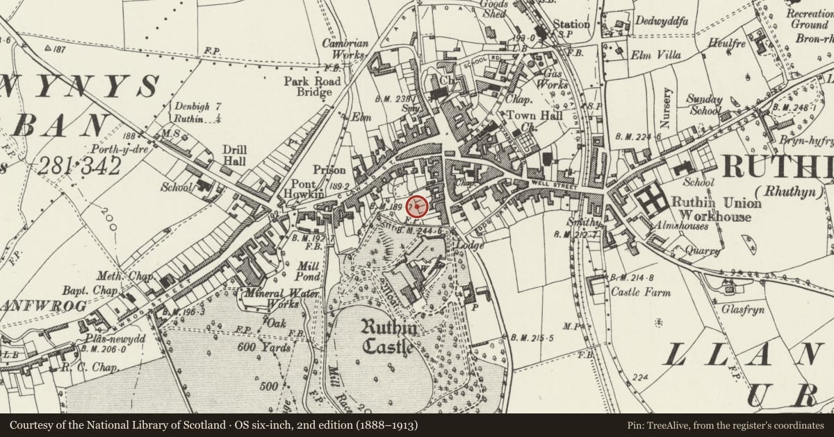
Slide toward Today to fade the historical sheet and see the modern map underneath.
David Rumsey Map Collection, Stanford LibrariesDavid Rumsey Map Collection, Stanford LibrariesLlyfrgell Genedlaethol Cymru – The National Library of WalesDavid Rumsey Map Collection, Stanford LibrariesDavid Rumsey Map Collection, Stanford Libraries
5 historical maps cover this location, the earliest the 1795 map "To Sir Watkin Williams-Wynn Bart ... the map of the six counties of North Wales is most humbly inscribed by his obedient humble servant" (Llyfrgell Genedlaethol Cymru – The National Library of Wales).
Historical maps covering this location
- 1795 · To Sir Watkin Williams-Wynn Bart ... the map of the six counties of North Wales is most… (Llyfrgell Genedlaethol Cymru – The National Library of Wales)
- 1830 · V.3:11-15:XV. Britisches Reich. A. Kon: England. b. Frstenthum Wales: Shire: 37-40 (David Rumsey Map Collection, Stanford Libraries)
- 1883 · Watershed map England, Wales 3. (David Rumsey Map Collection, Stanford Libraries)
- 1898 · 108 Flint (Hills) (David Rumsey Map Collection, Stanford Libraries)
- 1901 · Sheet 9 and 10. (David Rumsey Map Collection, Stanford Libraries)
Cadw's description
Location
Located at the W end of the garden of 14a Castle Street, the rear attached to the walls of the Lord's Garden, Nantclwyd House.
History
Probably early-mid C19; shown on the 1st edition Ordnance Survey of 1874. At one time, the gazebo was used as accommodation for the coach drivers, each room, to upper and lower storey, with its own fireplace. It is now a garden structure. The gables were rebuilt and the roof replaced in the late C20.
Exterior
Gable-fronted, 2-storey 1-window gazebo, constructed of red brick under a slate roof with plain barge boards; lateral brick stack to N side. The openings have segmental brick heads. East front has boarded door to ground floor, flanked by small 2-over-4-pane hornless sashes. Upper storey has tall 12-pane horned sash. South side has 1st floor boarded door, reached by modern open timber stairs. North side has 2 small window openings to upper storey, that to R containing a 2-over-4-pane sash, that to L blocked with brick; lower storey not seen. West gable end has a tall 2-light wooden casement to upper storey, the lower storey forming part of the garden walls.
Interior
Interior not inspected.
Reason for designation
Listed as a good early C19 garden gazebo retaining its architectural character, and for group value with the garden walls of Nantclwyd House.
Nearby in the register
- Garden Walls to Nantclwyd HouseDomesticunder 1 mi
- Walls of former Lord's Garden at rear of Nantclwyd HouseNo class recordedunder 1 mi
- Gazebo to rear of Nantclwyd HouseGardens, Parks and Urban Spacesunder 1 mi
- Bron y GaerDomesticunder 1 mi
Other entries of the same register within about three miles of this one, by straight line.