Cof Cymru: National Historic Assets of Wales · Wales
Street Wall, Gatepiers and Gates of Llanddewi Rhydderch Baptist Chapel
Gobion Fawr, Monmouthshire, Wales
A Grade II listed building in Llanddewi Rhydderch, Abergavenny, Gobion Fawr, Monmouthshire, designated on 9 December 2005.
The record
- Designation
- Listed building, Grade II
- Broad class
- Religious, Ritual and Funerary
- Date of designation
- 9 December 2005
- Locality
- Llanddewi Rhydderch
- Town
- Abergavenny
- Community
- Gobion Fawr
- Unitary authority
- Monmouthshire
- Country
- Wales
- Coordinates
- 51.80749, -2.95019
- Cadw reference
- 87193
Slide toward Today to fade the historical sheet and see the modern map underneath.
David Rumsey Map Collection, Stanford LibrariesDavid Rumsey Map Collection, Stanford LibrariesDavid Rumsey Map Collection, Stanford LibrariesDavid Rumsey Map Collection, Stanford LibrariesDavid Rumsey Map Collection, Stanford Libraries
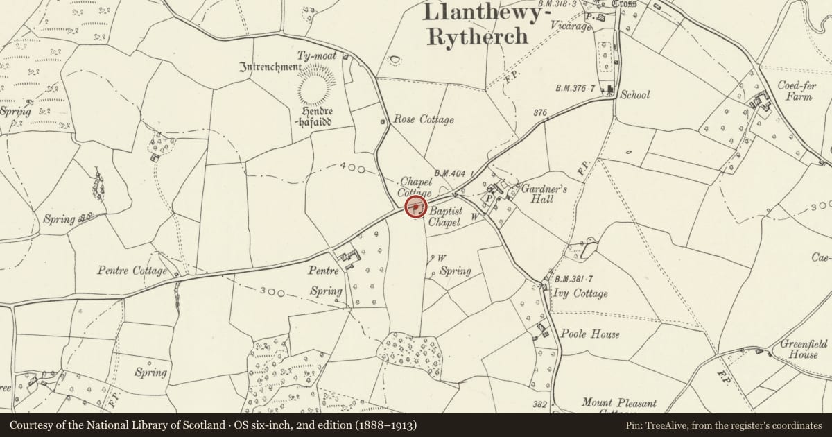
5 historical maps cover this location, the earliest the 1636 map "Cornubia : Devonia, Somersetus, Dorcestria, Wiltonia, Glocestria ..." (David Rumsey Map Collection, Stanford Libraries).
Historical maps covering this location
- 1636 · Cornubia : Devonia, Somersetus, Dorcestria, Wiltonia, Glocestria ... (David Rumsey Map Collection, Stanford Libraries)
- 1895 · Sheet 11. Ordnance Survey of England and Wales. (David Rumsey Map Collection, Stanford Libraries)
- 1898 · 232 Abergavenny (Hills) (David Rumsey Map Collection, Stanford Libraries)
- 1898 · 232 Abergavenny (Outline) (David Rumsey Map Collection, Stanford Libraries)
- 1901 · Sheet 14. (David Rumsey Map Collection, Stanford Libraries)
Cadw's description
Location
Bounding the Chapel graveyard on the roadside.
History
Mid/late C19, possibly contemporary with the extension of the chapel (qv), and unaltered since building.
Exterior
Wall of random sandstone rubble now largely hidden by a thick growth of ivy. Semi-ashlar gatepiers with conical caps. Wrought iron spear head double gates with dog-bars.
Reason for designation
Included for its special interest as having group value with the adjoining chapel.
Nearby in the register
- Llanddewi Rhydderch Baptist ChapelReligious, Ritual and Funeraryunder 1 mi
- Cross in Churchyard of Church of St. DavidReligious, Ritual and Funeraryunder 1 mi
- Llanthewy-Rhytherch Churchyard Cross-BaseCrossunder 1 mi
- Church of St. DavidReligious, Ritual and Funeraryunder 1 mi
Other entries of the same register within about three miles of this one, by straight line.