Cof Cymru: National Historic Assets of Wales · Wales
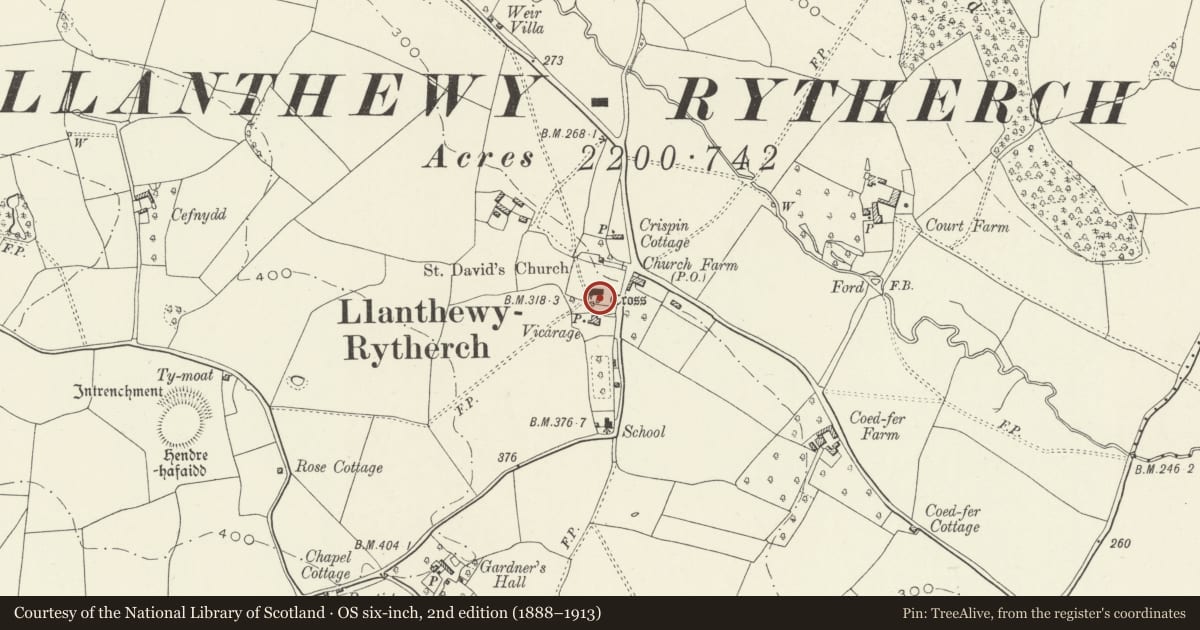
Cross in Churchyard of Church of St. David
Gobion Fawr, Monmouthshire, Wales
A Grade II listed building in Llanddewi Rhydderch, Abergavenny, Gobion Fawr, Monmouthshire, designated on 9 January 1956.
The record
- Designation
- Listed building, Grade II
- Broad class
- Religious, Ritual and Funerary
- Date of designation
- 9 January 1956
- Locality
- Llanddewi Rhydderch
- Town
- Abergavenny
- Community
- Gobion Fawr
- Unitary authority
- Monmouthshire
- Country
- Wales
- Coordinates
- 51.81140, -2.94435
- Cadw reference
- 1983
Slide toward Today to fade the historical sheet and see the modern map underneath.
David Rumsey Map Collection, Stanford LibrariesDavid Rumsey Map Collection, Stanford LibrariesDavid Rumsey Map Collection, Stanford LibrariesDavid Rumsey Map Collection, Stanford LibrariesDavid Rumsey Map Collection, Stanford Libraries
5 historical maps cover this location, the earliest the 1636 map "Cornubia : Devonia, Somersetus, Dorcestria, Wiltonia, Glocestria ..." (David Rumsey Map Collection, Stanford Libraries).
Historical maps covering this location
- 1636 · Cornubia : Devonia, Somersetus, Dorcestria, Wiltonia, Glocestria ... (David Rumsey Map Collection, Stanford Libraries)
- 1895 · Sheet 11. Ordnance Survey of England and Wales. (David Rumsey Map Collection, Stanford Libraries)
- 1898 · 232 Abergavenny (Hills) (David Rumsey Map Collection, Stanford Libraries)
- 1898 · 232 Abergavenny (Outline) (David Rumsey Map Collection, Stanford Libraries)
- 1901 · Sheet 14. (David Rumsey Map Collection, Stanford Libraries)
Cadw's description
Location
In the churchyard on the north side of the church.
History
A probably late C15 medieval cross which was restored in 1923.
Exterior
Constructed from red sandstone blocks. Three square diminishing steps on a stone base, the bottom step with moulded nosing. The broached socket stone is unusually large and well-defined. The base of the shaft is medieval; the rest with the gabled Crucifix was added in 1923.
Reason for designation
Included for its special interest as the well-preserved base of a late medieval cross with good quality C20 embellishment.
Scheduled Ancient Monument: MM117(MON) - called Llanthewy-Rhytherch Churchyard Cross-Base.
Nearby in the register
- Llanthewy-Rhytherch Churchyard Cross-BaseCrossunder 1 mi
- Church of St. DavidReligious, Ritual and Funeraryunder 1 mi
- Street Wall, Gatepiers and Gates of Llanddewi Rhydderch Baptist ChapelReligious, Ritual and Funeraryunder 1 mi
- Llanddewi Rhydderch Baptist ChapelReligious, Ritual and Funeraryunder 1 mi
Other entries of the same register within about three miles of this one, by straight line.