Cof Cymru: National Historic Assets of Wales · Wales
Mill House
Goetre Fawr, Monmouthshire, Wales
A Grade II listed building in Llanover, Abergavenny, Goetre Fawr, Monmouthshire, designated on 9 December 2005.
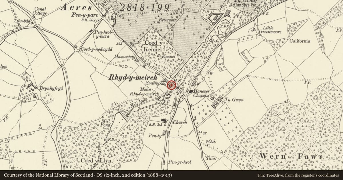
The record
- Designation
- Listed building, Grade II
- Broad class
- Domestic
- Date of designation
- 9 December 2005
- Locality
- Llanover
- Town
- Abergavenny
- Community
- Goetre Fawr
- Unitary authority
- Monmouthshire
- Country
- Wales
- Coordinates
- 51.76605, -2.99459
- Cadw reference
- 87174
Slide toward Today to fade the historical sheet and see the modern map underneath.
David Rumsey Map Collection, Stanford LibrariesDavid Rumsey Map Collection, Stanford LibrariesDavid Rumsey Map Collection, Stanford LibrariesDavid Rumsey Map Collection, Stanford LibrariesDavid Rumsey Map Collection, Stanford Libraries
5 historical maps cover this location, the earliest the 1636 map "Cornubia : Devonia, Somersetus, Dorcestria, Wiltonia, Glocestria ..." (David Rumsey Map Collection, Stanford Libraries).
Historical maps covering this location
- 1636 · Cornubia : Devonia, Somersetus, Dorcestria, Wiltonia, Glocestria ... (David Rumsey Map Collection, Stanford Libraries)
- 1895 · Sheet 11. Ordnance Survey of England and Wales. (David Rumsey Map Collection, Stanford Libraries)
- 1898 · 232 Abergavenny (Hills) (David Rumsey Map Collection, Stanford Libraries)
- 1898 · 232 Abergavenny (Outline) (David Rumsey Map Collection, Stanford Libraries)
- 1913 · Sheet 102. Newport. (David Rumsey Map Collection, Stanford Libraries)
Cadw's description
Location
Facing south towards Pont Rhyd-y-meirch at the south end of Llanover village.
History
The house may have C18 or early C19 origins, but external detail is of later C19 character, the detail itself renewed in late C20 restoration.
Exterior
The house is completely smooth rendered and painted, probably over local rubblestone, with a replacement natural slate roof and rendered stacks. Double depth central entry plan. Two storeys, three windows, with an additional ground floor one. Central part glazed door with beside it on the left a small 2 over 2 pane sash both under a slated porch on slim posts. Larger 2 over 2 sashes flank this and above three smaller sashes with marginal glazing. All are in plain openings and have replacement joinery. Replacement roof with all round overhang, stack to each gable. Small windows in both gable ends.
Rear elevation has all replacement sashes with a smaller one at upper centre.
Interior
Interior not seen at resurvey.
Reason for designation
Included for group value within this important estate village.
Nearby in the register
- Pen CefylDomesticunder 1 mi
- Pen CefylDomesticunder 1 mi
- Pen CefylDomesticunder 1 mi
- Milestone-Abergavenny 4Transportunder 1 mi
Other entries of the same register within about three miles of this one, by straight line.