Cof Cymru: National Historic Assets of Wales · Wales
Barn at Llwyn-celyn
Goetre Fawr, Monmouthshire, Wales
A Grade II listed building in Upper Llanover, Abergavenny, Goetre Fawr, Monmouthshire, designated on 9 December 2005.
The record
- Designation
- Listed building, Grade II
- Broad class
- Agriculture and Subsistence
- Date of designation
- 9 December 2005
- Locality
- Upper Llanover
- Town
- Abergavenny
- Community
- Goetre Fawr
- Unitary authority
- Monmouthshire
- Country
- Wales
- Coordinates
- 51.76711, -3.00916
- Cadw reference
- 87135
Slide toward Today to fade the historical sheet and see the modern map underneath.
David Rumsey Map Collection, Stanford LibrariesDavid Rumsey Map Collection, Stanford LibrariesDavid Rumsey Map Collection, Stanford LibrariesDavid Rumsey Map Collection, Stanford LibrariesDavid Rumsey Map Collection, Stanford Libraries
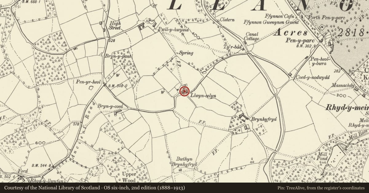
5 historical maps cover this location, the earliest the 1636 map "Cornubia : Devonia, Somersetus, Dorcestria, Wiltonia, Glocestria ..." (David Rumsey Map Collection, Stanford Libraries).
Historical maps covering this location
- 1636 · Cornubia : Devonia, Somersetus, Dorcestria, Wiltonia, Glocestria ... (David Rumsey Map Collection, Stanford Libraries)
- 1856 · 42. Brecon. (David Rumsey Map Collection, Stanford Libraries)
- 1898 · 232 Abergavenny (Hills) (David Rumsey Map Collection, Stanford Libraries)
- 1898 · 232 Abergavenny (Outline) (David Rumsey Map Collection, Stanford Libraries)
- 1913 · Sheet 102. Newport. (David Rumsey Map Collection, Stanford Libraries)
Cadw's description
Location
About 1km west of Llanover village on the north side of the minor road to Upper Llanover. The barn is between the house and the road.
History
A possibly early C19 combination farmbuilding, though maybe incorporating earlier fabric and with a lower and later addition.
Exterior
The stonework is very varied, both squared and random rubble in local red sandstone suggesting alterations and repairs at different times, concrete tile main roof with natural slate to the addition. The street elevation has a large flat topped, now blocked doorway on the left and a doorway with an segmental brick arch to the right, beyond this a small door. The right gable has a smaller outhouse with window and door and a lower roof. Its gable end has a later lean-to with small window. Left gable has slit vent.
Rear elevation plain.
Interior
Interior not available at resurvey.
Reason for designation
Included for its special interest as a C19 combination farm building which has strong group value with the farmhouse.
Nearby in the register
- Llwyn-celynDomesticunder 1 mi
- Granary/Stable at Bryn-hyfrydAgriculture and Subsistenceunder 1 mi
- Bryn-hyfrydNo class recordedunder 1 mi
- Pwllyrhwyaid FarmhouseDomesticunder 1 mi
Other entries of the same register within about three miles of this one, by straight line.