Cof Cymru: National Historic Assets of Wales · Wales
Pwllyrhwyaid Farmhouse
Goetre Fawr, Monmouthshire, Wales
A Grade II listed building in Upper Llanover, Goetre Fawr, Monmouthshire, designated on 3 July 2007.
The record
- Designation
- Listed building, Grade II
- Broad class
- Domestic
- Date of designation
- 3 July 2007
- Locality
- Upper Llanover
- Community
- Goetre Fawr
- Unitary authority
- Monmouthshire
- Country
- Wales
- Coordinates
- 51.77003, -3.01113
- Cadw reference
- 87533
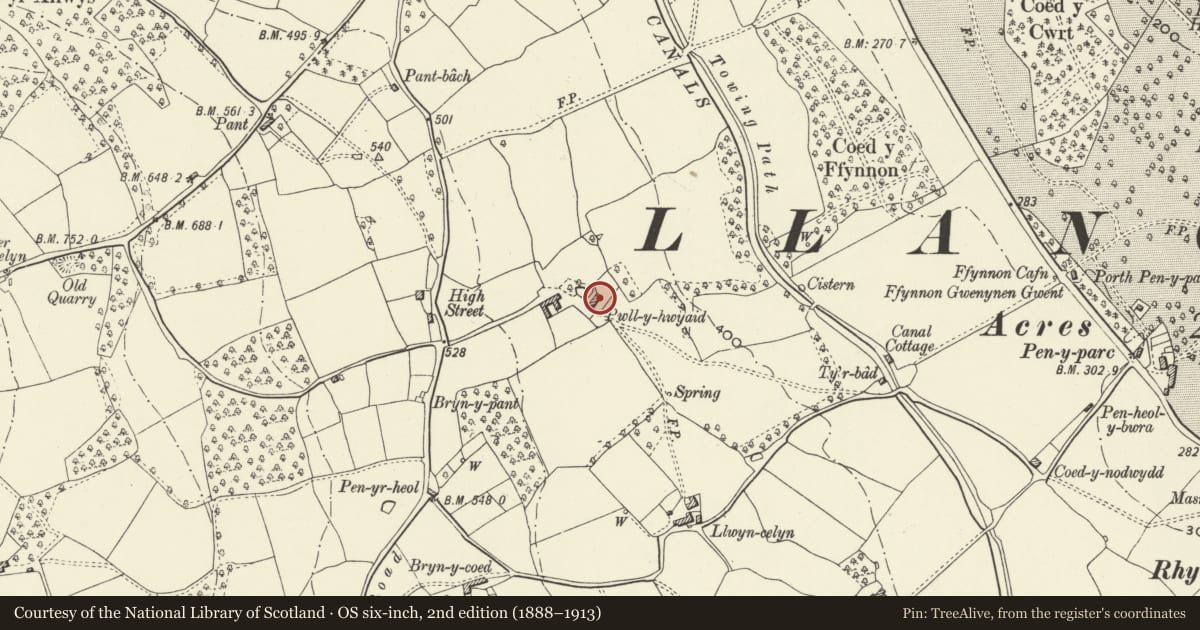
Slide toward Today to fade the historical sheet and see the modern map underneath.
David Rumsey Map Collection, Stanford LibrariesDavid Rumsey Map Collection, Stanford LibrariesDavid Rumsey Map Collection, Stanford LibrariesDavid Rumsey Map Collection, Stanford LibrariesDavid Rumsey Map Collection, Stanford Libraries
5 historical maps cover this location, the earliest the 1636 map "Cornubia : Devonia, Somersetus, Dorcestria, Wiltonia, Glocestria ..." (David Rumsey Map Collection, Stanford Libraries).
Historical maps covering this location
- 1636 · Cornubia : Devonia, Somersetus, Dorcestria, Wiltonia, Glocestria ... (David Rumsey Map Collection, Stanford Libraries)
- 1856 · 42. Brecon. (David Rumsey Map Collection, Stanford Libraries)
- 1898 · 232 Abergavenny (Hills) (David Rumsey Map Collection, Stanford Libraries)
- 1898 · 232 Abergavenny (Outline) (David Rumsey Map Collection, Stanford Libraries)
- 1913 · Sheet 102. Newport. (David Rumsey Map Collection, Stanford Libraries)
Cadw's description
Location
About 1km W of Llanover Village, reached by track off minor road.
History
Probably mid C17 and later. Fox & Raglan recorded ovolo windows, a shaped doorhead, notched collars to the roof trusses, and scroll stopped beams.
Exterior
Farmhouse; two storeys; stone, mainly smooth render; stone slate roof; rectangular brick chimneys to ends with another on ridge towards SW.
Long entrance front faces SE; exposed stone section to R; four windows at first foor level. On ground floor, in third bay, a gabled porch with round-arched doorway. At L end, a lean-to block. Right gable end has 2 windows to each floor. Rear has a lean-to block at NE end, and a large early C20 porch with stone slate roof supported on 3 tapering posts resting on low wall.
Interior
Not available.
Reason for designation
Listed for its origins as a mid C17 regional type farmhouse, and for group value with adjacent agricultural range.
Nearby in the register
- Barn and Cowhouse at Pwllyrhwaid FarmNo class recordedunder 1 mi
- Overflow on Monmouthshire and Brecon Canal between Bridges 82 and 83Transportunder 1 mi
- Bridge No. 82 Monmouthshire and Brecon CanalTransportunder 1 mi
- Llwyn-celynDomesticunder 1 mi
Other entries of the same register within about three miles of this one, by straight line.